
Free Surveyor Invoice Generator
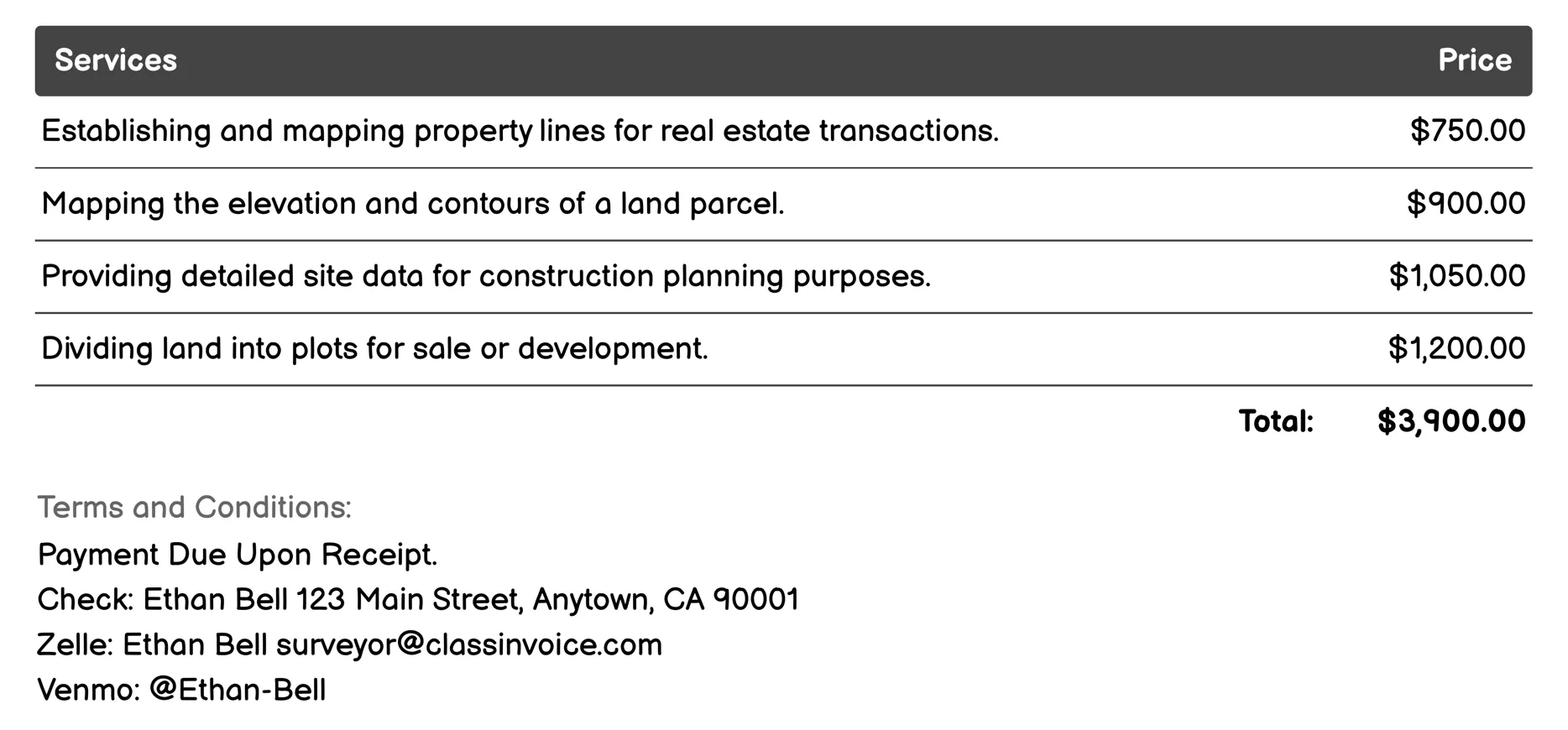
Land Surveying Invoice
The 'Surveyor for Land Surveying' service provides a comprehensive range of surveys crucial for property management and development. It includes boundary, topographic, site planning, subdivision, ALTA/NSPS, as-built, construction staking, and easement surveys, among others. These services ensure accurate land data, facilitate real estate transactions, support construction projects, and resolve disputes over property lines or easements.
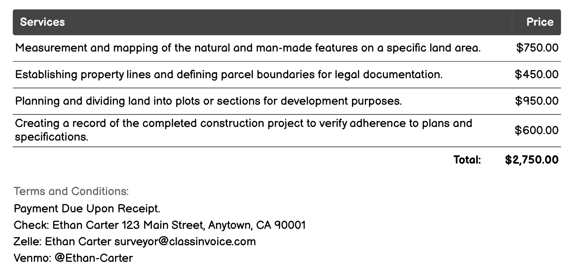
Construction Surveying Invoice
Surveyor for Construction Surveying provides comprehensive land assessment services. It includes topographic, boundary, and subdivision surveys to map features and property lines. Construction staking helps builders follow design plans accurately. As-built surveys verify project completion against specifications. Site planning ensures optimal layout before construction, while utility location prevents damage during digging. Elevation surveys aid in drainage and leveling, and aerial photogrammetry creates detailed land maps or 3D models. Environmental surveying evaluates soil conditions and ecological impacts, ensuring safe and compliant construction practices.
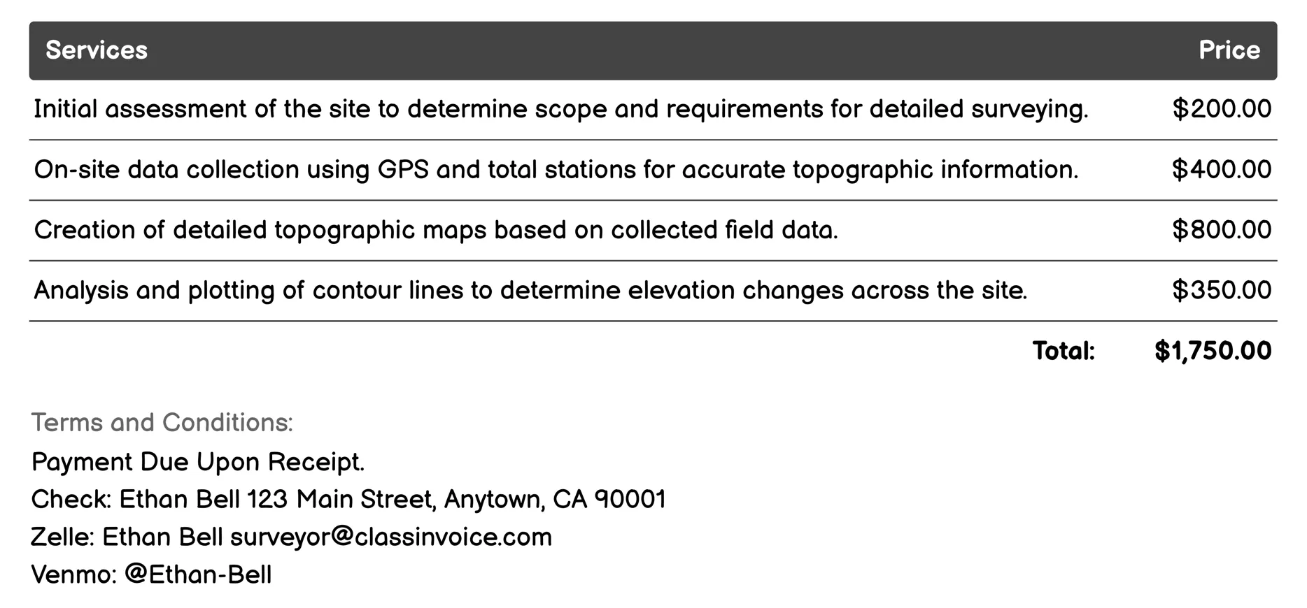
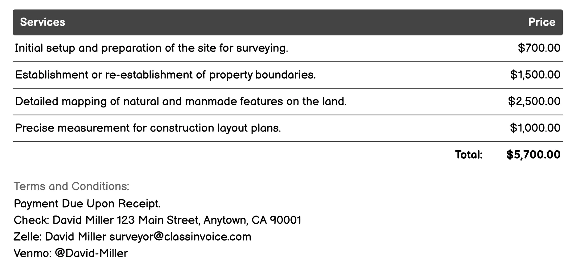
Topographic Surveying Invoice
This service involves assessing and mapping land features for topographic surveys. It includes gathering on-site data using GPS, creating detailed maps, analyzing elevation changes, and surveying water bodies. The process also covers identifying property boundaries, cataloging physical landmarks, and reviewing the accuracy of collected information. Finally, findings are compiled into a comprehensive report with visuals to ensure clarity and completeness for invoicing purposes.
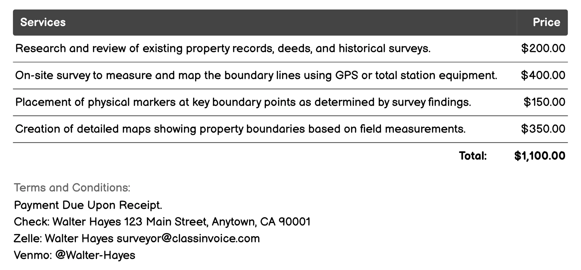
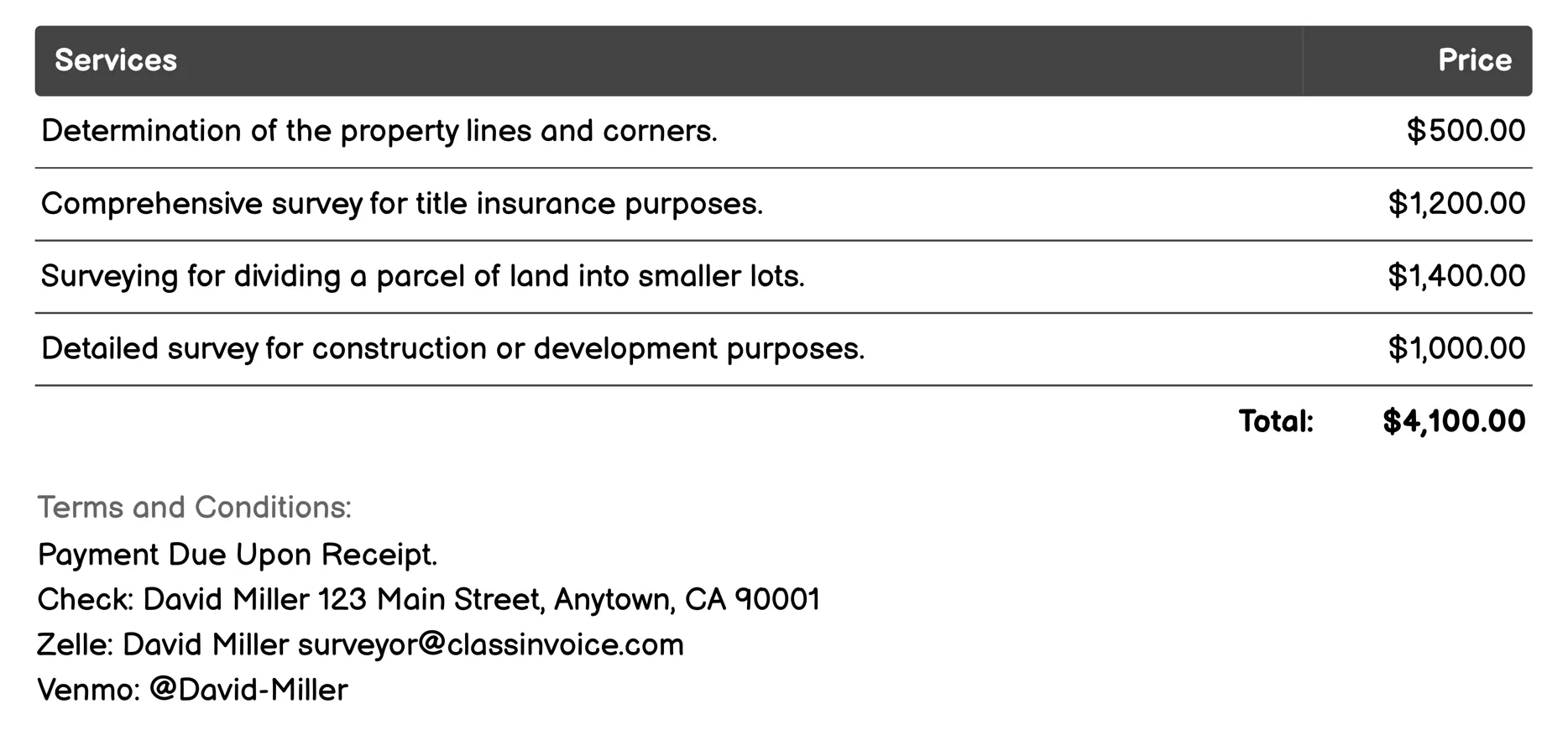
Boundary Surveying Invoice
Surveyor for Boundary Surveying provides comprehensive boundary analysis services, including research, field measurements, and legal documentation. It involves on-site surveys using GPS technology to map property lines accurately, placement of physical markers, and creation of detailed maps. The service also includes consultations to resolve disputes, preparation of necessary legal documents, and compliance checks with local regulations. A complete survey report is compiled for stakeholders, ensuring clarity in property boundaries.
ALTA/NSPS Surveying Invoice
Surveyor for ALTA/NSPS Surveying offers comprehensive services tailored to property and land management needs. This includes determining boundaries, conducting surveys for title insurance, planning subdivisions, creating site plans, verifying completed constructions, ensuring mortgage satisfaction, resolving boundary disputes, satisfying lender requirements, mapping site features, and assessing environmental risks. Each service is designed to meet specific standards set by the American Land Title Association (ALTA) and the National Society of Professional Surveyors (NSPS), ensuring accuracy and legal compliance.
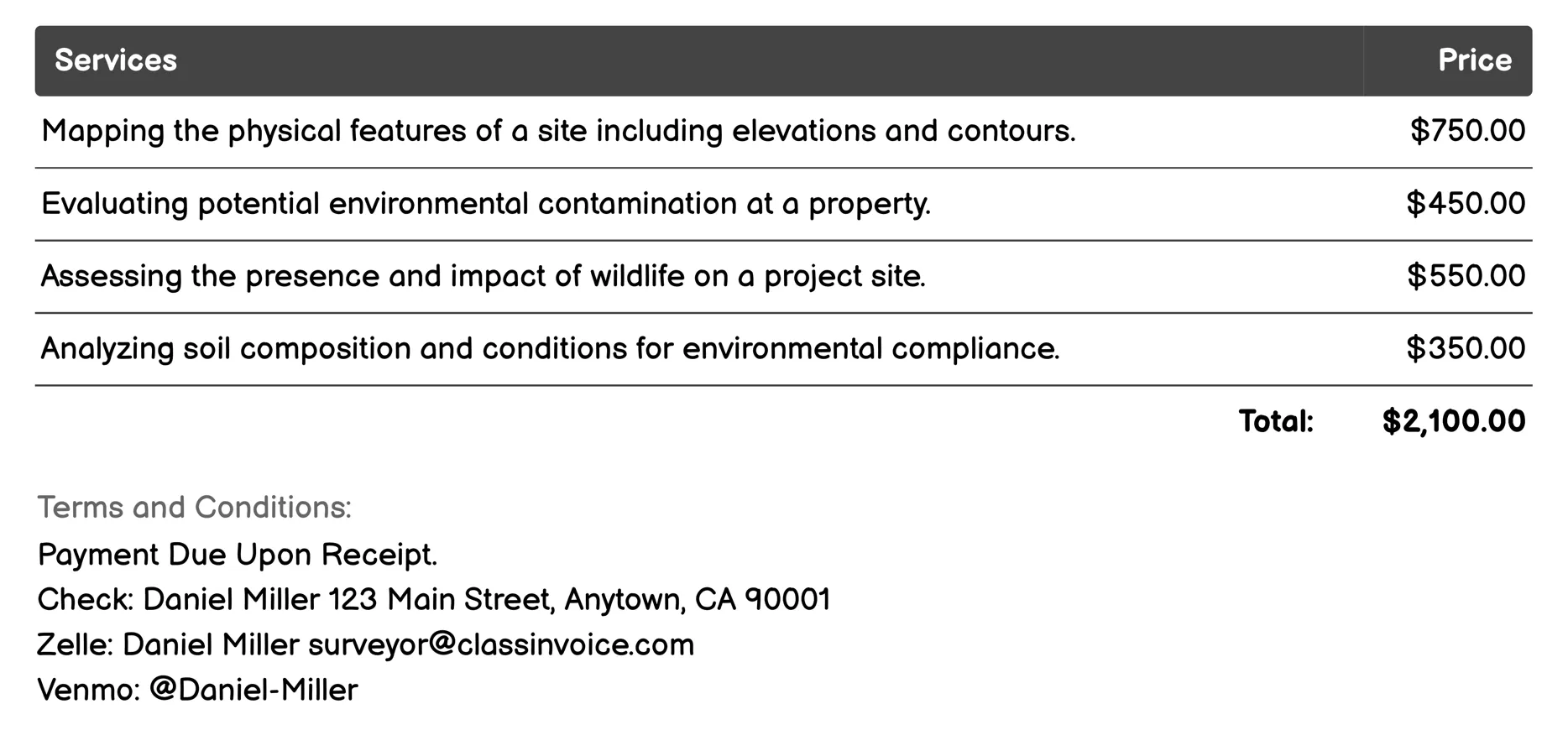
Environmental Surveying Invoice
Surveyor for Environmental Surveying offers diverse services to assess and map natural features, contamination levels, wildlife habitats, and soil conditions. It includes topographical mapping, contamination site assessments, habitat surveys, and vegetation documentation. The service also covers hydrological studies, wetland delineation, noise, air quality, and visual impact evaluations. These comprehensive environmental analyses ensure regulatory compliance and inform project planning.

Subdivision Surveying Invoice
Surveyor for Subdivision Surveying offers comprehensive services essential for planning and developing land subdivisions. These include mapping property boundaries, topography, and existing utilities; creating preliminary site plans and detailed subdivision plats; assisting with legal approval processes; and assessing environmental impacts. The service ensures compliance with local regulations through final plat reviews, while also providing site grading and easement surveys to optimize land use and infrastructure integration.
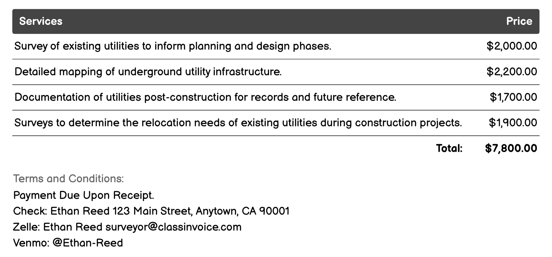
Utility Surveying Invoice
Surveyor for Utility Surveying provides comprehensive services to manage and document underground utilities. These include pre-construction surveys, detailed mapping, as-built documentation, and conflict detection. The service ensures regulatory compliance and conducts safety audits to prevent damage or conflicts during construction. Non-invasive methods are used for identifying underground lines, aiding in relocation and repair assessments. Environmental impacts are also evaluated, ensuring safe and efficient utility operation.
As-built Surveying Invoice
Surveyor for As-built Surveying provides comprehensive services to ensure accurate documentation and analysis post-construction. It includes site preparation, boundary establishment, topographic mapping, building layout measurements, utility location, as-built records creation, structural assessment, and comparison of actual construction against original plans. The service culminates in a detailed final inspection and report for quality assurance, helping clients verify project completion according to specifications.
FAQ
Is the invoice creation process free ?
Yes, creating an invoice using our service is completely free of charge.
Can I use this service for personal or business purposes ?
This service can be used for both personal and business purposes. No registration or subscription is required.
What can I do with the online invoice creation tool ?
You can create and print invoices, or download them in PDF format for free.
How do I get my printed or PDF invoices ?
You can print your invoices directly from the invoice creation tool, or download them in PDF format for free.
Is the invoice creation process secure ?
Yes, all data is encrypted and stored securely to protect your information.