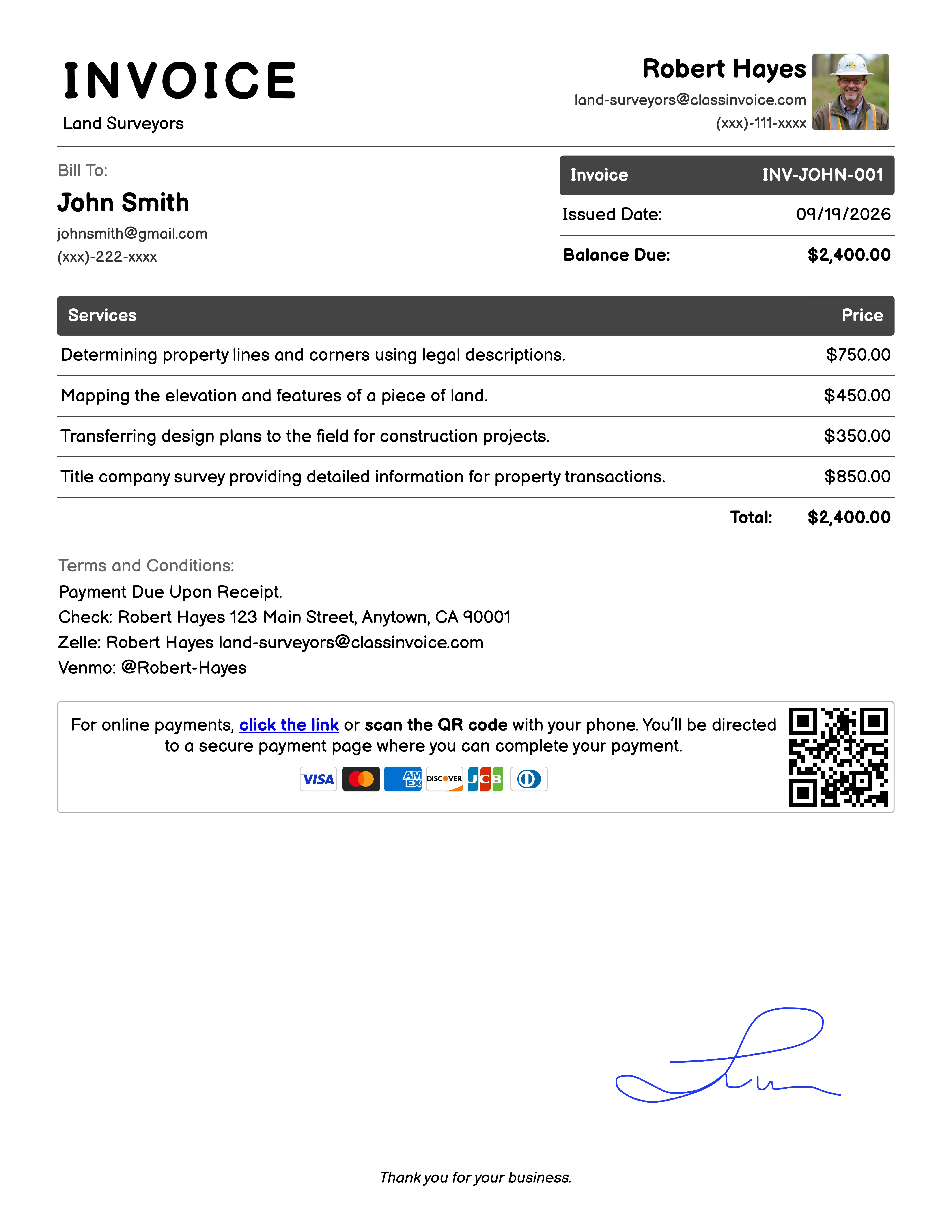
Free Land Surveyors Invoice Generator
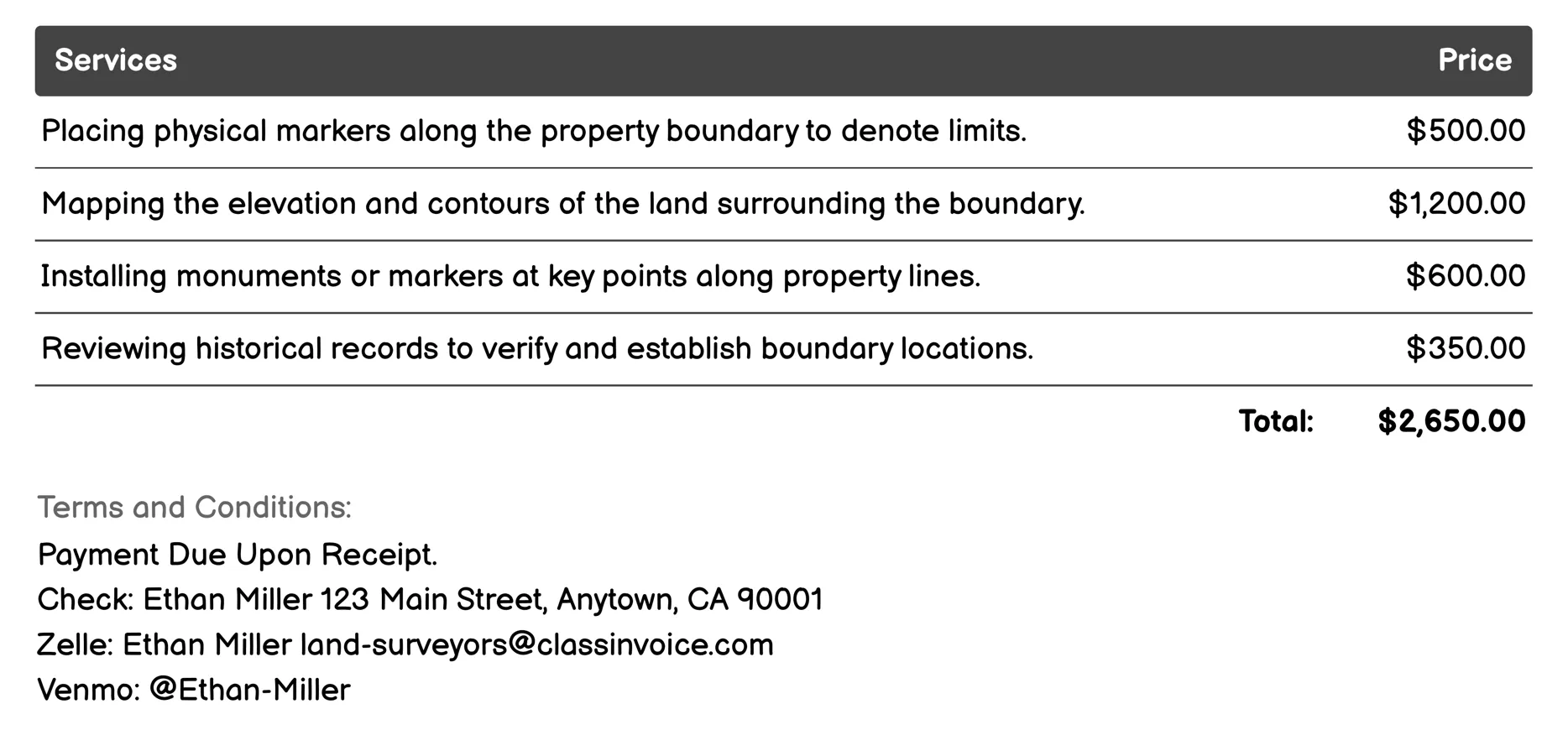
Boundary Surveys Invoice
This service involves professional land surveyors conducting boundary surveys. They place markers to define property limits, map land contours, and verify boundaries through historical research. Services include resolving disputes, adjusting lines, restoring original boundaries, and preparing legal documents for transactions or court cases. These surveys are crucial for property sales, development, or legal resolutions, ensuring accurate and legally recognized property lines.
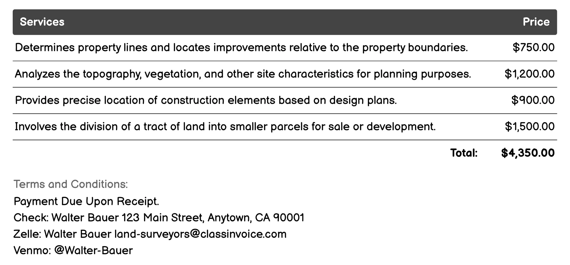
Topographic Surveys Invoice
Land surveyors provide topographic surveys to accurately map and analyze land features. This service includes determining property boundaries, assessing site characteristics for planning, ensuring precise construction locations, aiding in subdivision development, and identifying erosion-prone areas. Surveys also evaluate environmental impacts, create detailed maps of natural and man-made features, locate underground utilities, record land ownership details, and identify easements on properties.
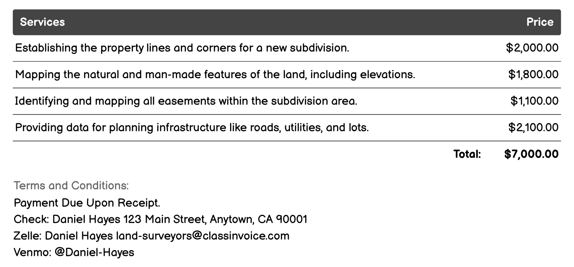
Subdivision Surveys Invoice
Land Surveyors for Subdivision Surveys offer comprehensive services to plan and develop new subdivisions. They provide detailed boundary surveys to establish property lines, topographic surveys to map land features, and easement mapping to identify legal rights over the land. Their site planning helps design infrastructure like roads and utilities efficiently, while setback analysis ensures compliance with zoning laws. Utility locating avoids construction hazards by marking underground utilities. Drainage plans manage water flow effectively. Lot layout designs create organized subdivisions. Construction staking guides builders accurately, and as-built surveys ensure constructions meet planned specifications.
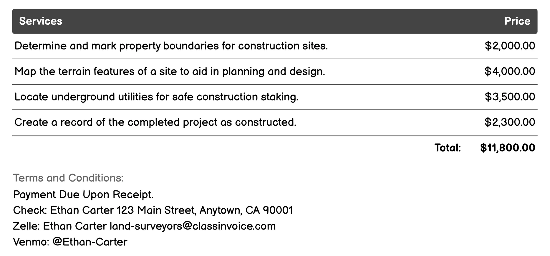
Construction Staking Invoice
Land Surveyors for Construction Staking provide essential services to ensure safe and accurate construction. They determine property boundaries, map terrain features, locate underground utilities, record completed projects, define legal land rights, precisely place structures, establish elevation points, assess drainage patterns, verify site plans, and identify environmental factors. These comprehensive surveys support planning, design, and execution of construction projects, preventing errors and ensuring compliance with regulations.
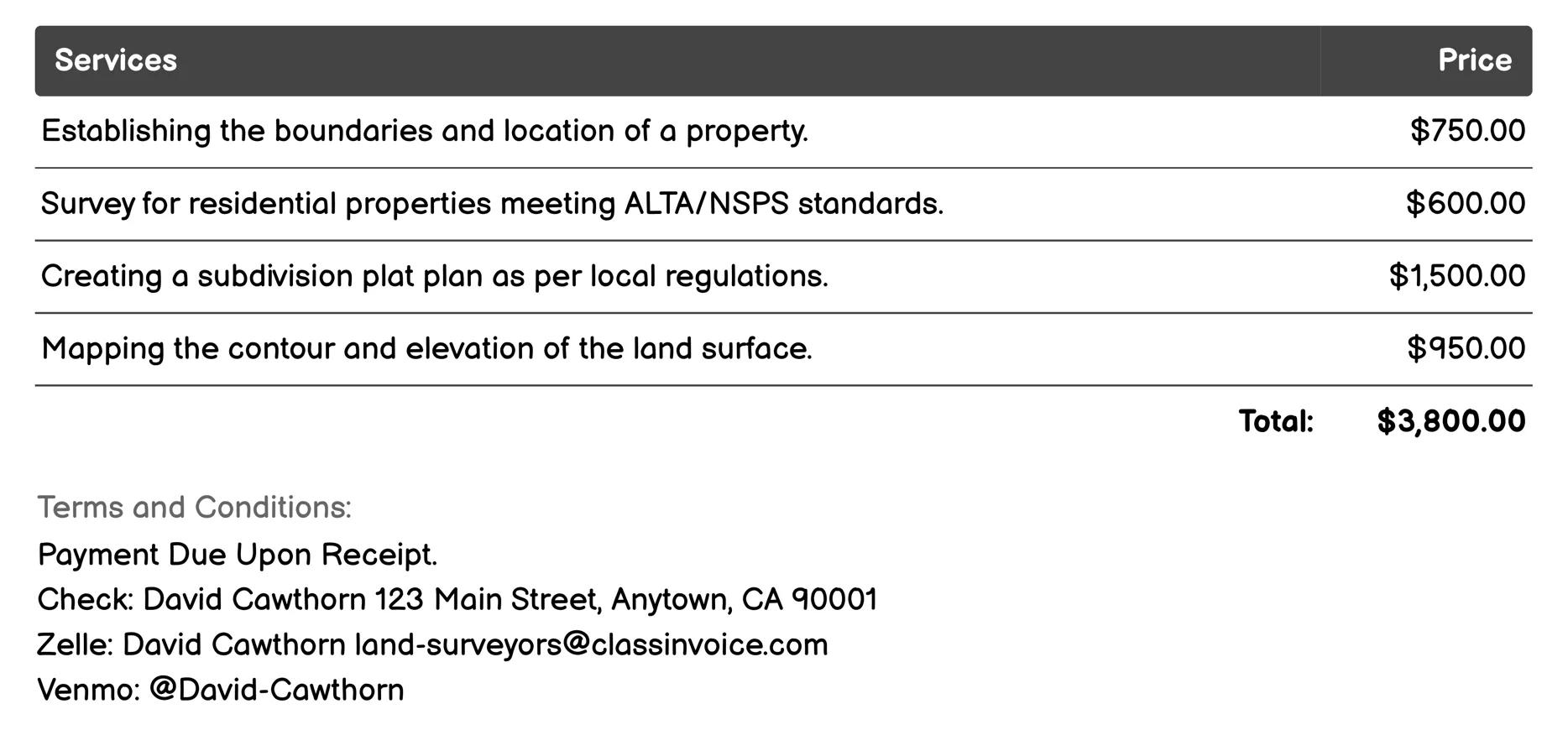
ALTA/NSPS Land Title Surveys Invoice
Land Surveyors for ALTA/NSPS Land Title Surveys provide precise and standardized property assessments. They establish boundaries, verify locations, and ensure compliance with rigorous standards for both residential and commercial properties. Their services include topographic mapping, floodplain determination, subdivision planning, and resolution of boundary disputes. By offering certification and staking for construction projects, they assist in legal documentation and development alignment, ensuring accuracy and reliability in property transactions and developments.
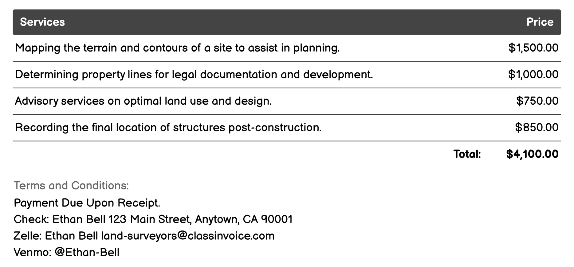
Site Planning and Development Invoice
Land surveyors provide essential services for site planning and development. They conduct detailed surveys to map terrain, determine property boundaries, and assess environmental impacts. Surveyors offer consultations on optimal land use and record construction details post-build. Their expertise includes subdividing land into parcels, identifying legal access routes, analyzing soil conditions, mapping underground utilities, and marking construction sites. These services ensure safe, efficient, and compliant development projects.
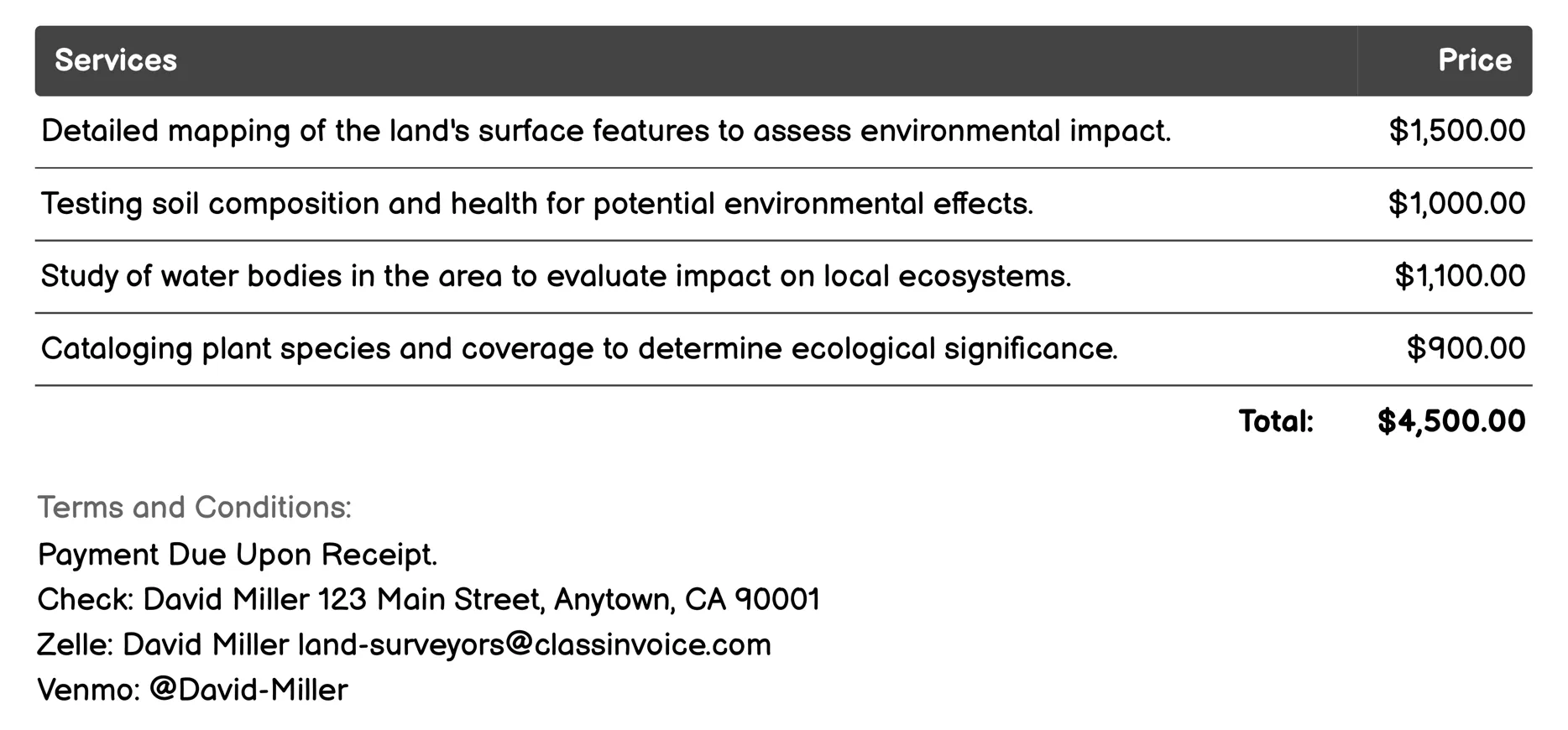
Environmental Impact Studies Invoice
Land surveyors specializing in environmental impact studies provide crucial services to assess and mitigate potential ecological effects. They conduct detailed topographic surveys, soil analysis, and hydrological studies. Their work includes vegetation mapping, wildlife habitat assessments, and locating cultural resources to prevent adverse impacts. Additionally, they monitor air quality, evaluate noise levels, analyze geotechnical properties, and plan erosion control strategies. These comprehensive evaluations help ensure sustainable development while preserving natural and cultural environments.
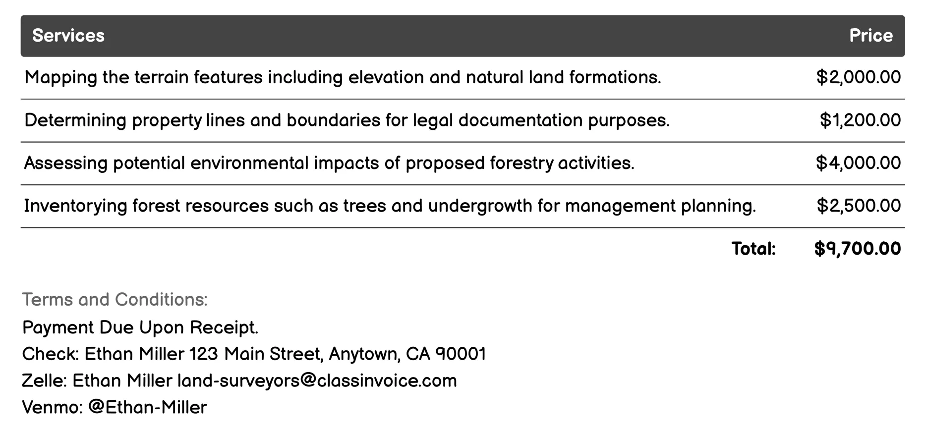
Forestry Surveys Invoice
Land Surveyors for Forestry Surveys offer a range of services essential for effective forest management. These include mapping terrain features, defining property boundaries, assessing environmental impacts, and inventorying resources like trees. Additional surveys focus on water bodies, soil quality, aerial imagery via drones, vegetation density, wildlife habitats, and accessibility routes. Such comprehensive data supports legal documentation, conservation efforts, and strategic planning in forestry.
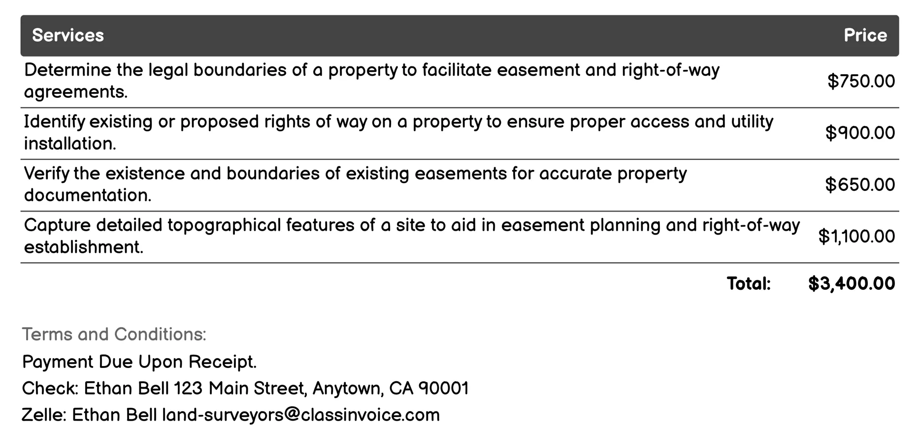
Easement and Right-of-Way Surveys Invoice
This service provides comprehensive surveys for property boundaries, easements, and rights-of-way. It includes locating right-of-way areas, verifying existing easements, mapping utilities, and assessing site conditions. Detailed documentation supports legal processes and compliance with regulations. The service aids in negotiations by offering technical support to ensure proper access and utility installations. It ensures all agreements align with local zoning laws, helping property owners manage rights and responsibilities effectively.
FAQ
Is the invoice creation process free ?
Yes, creating an invoice using our service is completely free of charge.
Can I use this service for personal or business purposes ?
This service can be used for both personal and business purposes. No registration or subscription is required.
What can I do with the online invoice creation tool ?
You can create and print invoices, or download them in PDF format for free.
How do I get my printed or PDF invoices ?
You can print your invoices directly from the invoice creation tool, or download them in PDF format for free.
Is the invoice creation process secure ?
Yes, all data is encrypted and stored securely to protect your information.