Free Land Surveyor Invoice Generator
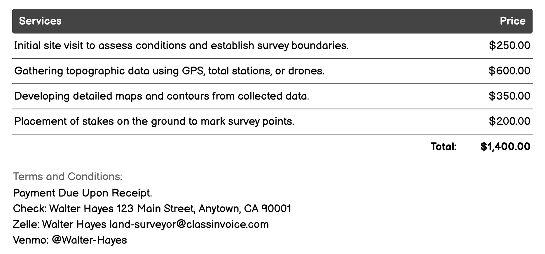
Topographic Surveying Invoice
This service provides expert land surveying for topographic projects. It includes site visits, data collection using advanced tools like GPS and drones, creating detailed maps, marking boundaries on-site, analyzing elevation, and mapping physical features. The service ensures accuracy through quality checks and compliance with standards, offering comprehensive reports and consultations to assist in planning and project development. This meticulous approach guarantees precise information for informed decision-making in construction, environmental management, and urban planning.
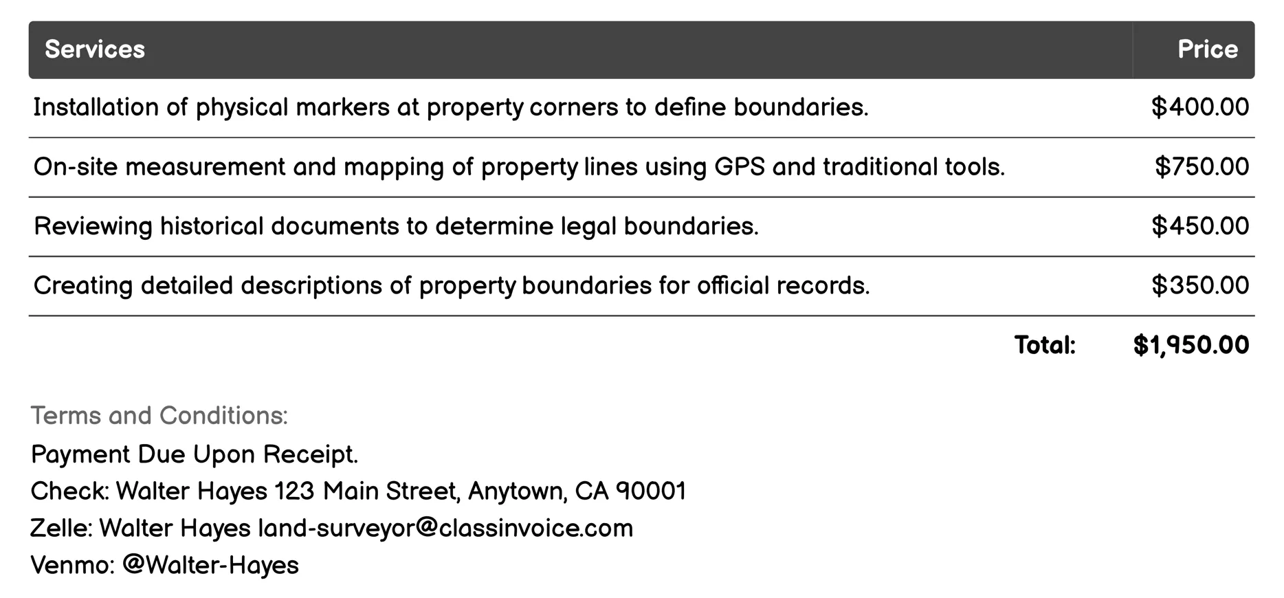
Boundary Surveys Invoice
The 'Land Surveyor for Boundary Surveys' service provides precise property boundary definitions and documentation. It includes installing physical markers, GPS mapping, reviewing historical records, and preparing official descriptions. This service helps resolve disputes with neighbors by mediating boundary issues and confirming construction compliance. Additionally, it offers topographic surveys to assist in planning and utilizes drones for enhanced data collection. The comprehensive survey reports deliver detailed findings to clients, ensuring accurate invoicing and legal clarity.
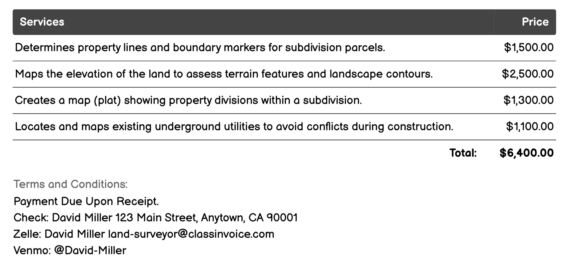
Subdivision Surveys Invoice
This service provides comprehensive land surveys for subdivisions, including boundary determination, topographic mapping, and plat preparation. It ensures accurate property lines, maps terrain features, and plans infrastructure like roads and drainage systems. The service also includes utility mapping to prevent construction conflicts and assesses environmental impacts. Legal descriptions are prepared for official records, and site grading plans ensure proper land use and drainage.
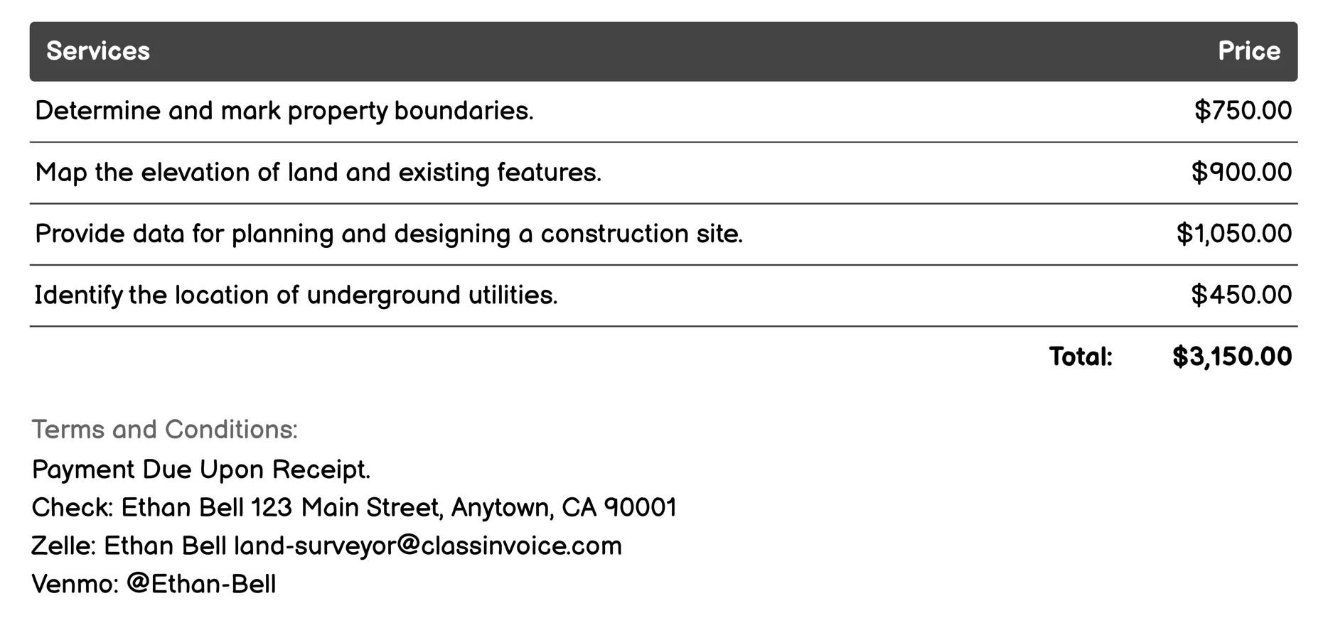
Construction Staking Invoice
A 'Land Surveyor for Construction Staking' service involves marking and measuring land to assist in construction projects. It includes tasks like determining property boundaries, mapping land elevations, planning sites, locating underground utilities, designing drainage systems, staking subdivisions, identifying easements, verifying new constructions, assessing environmental impacts, and surveying pavements. This service ensures that all spatial data is accurately recorded for safe and compliant development.
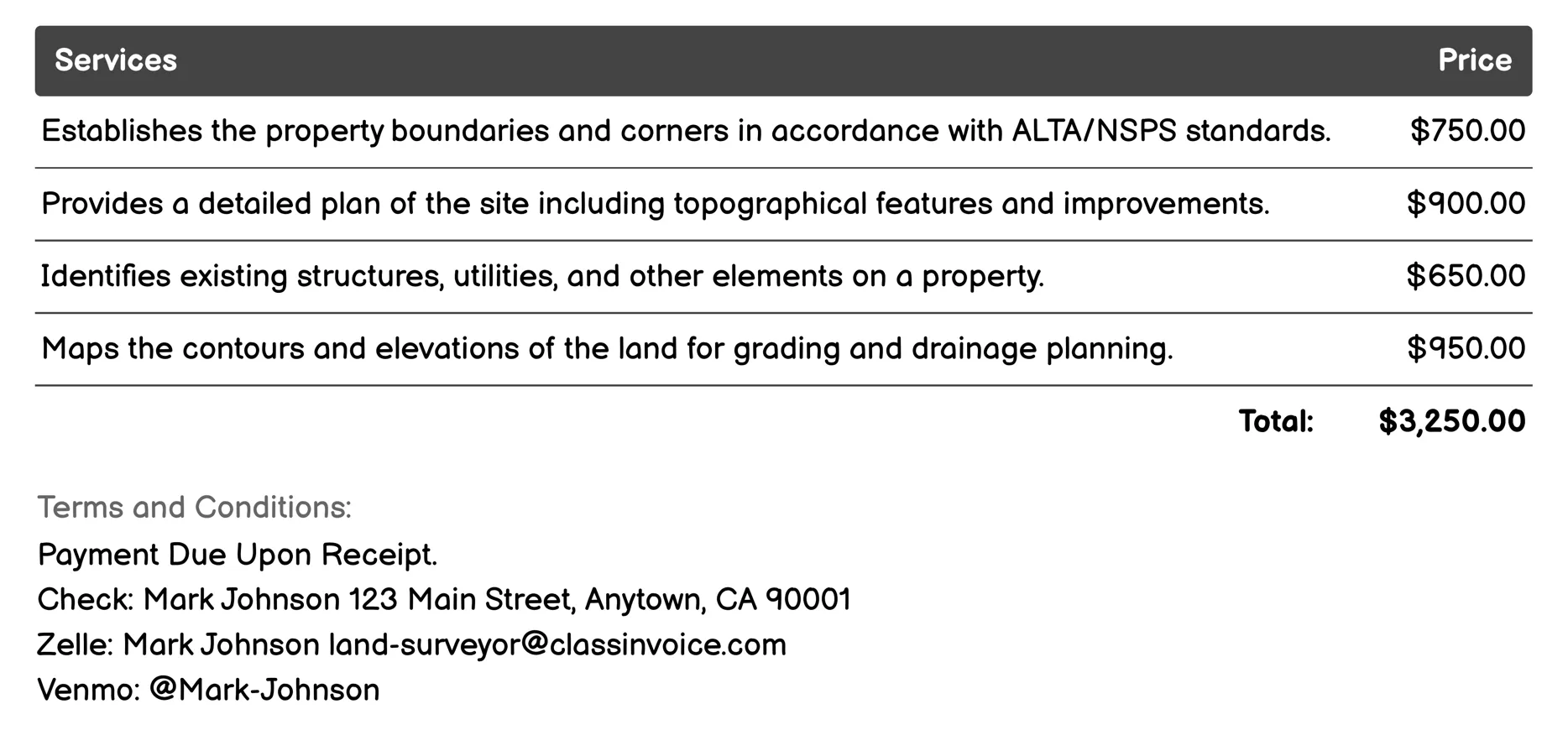
ALTA/NSPS Surveys Invoice
This service involves detailed land surveys adhering to ALTA/NSPS standards, crucial for various property-related tasks. It includes boundary and site plan surveys, topographic mapping, and more, ensuring precise documentation of property lines, easements, and features. Essential for legal compliance, construction planning, and real estate transactions, these surveys provide reliable data for title insurance and development projects.
Site Planning Invoice
The 'Land Surveyor for Site Planning' service involves detailed analysis and mapping of land features. It includes evaluating property boundaries, preparing sites for construction, documenting existing structures, assessing environmental impacts, dividing land for development, ensuring legal compliance in transactions, locating underground utilities, guiding construction with accurate staking, and recommending erosion control measures. This comprehensive surveying ensures informed planning and safe execution of development projects.
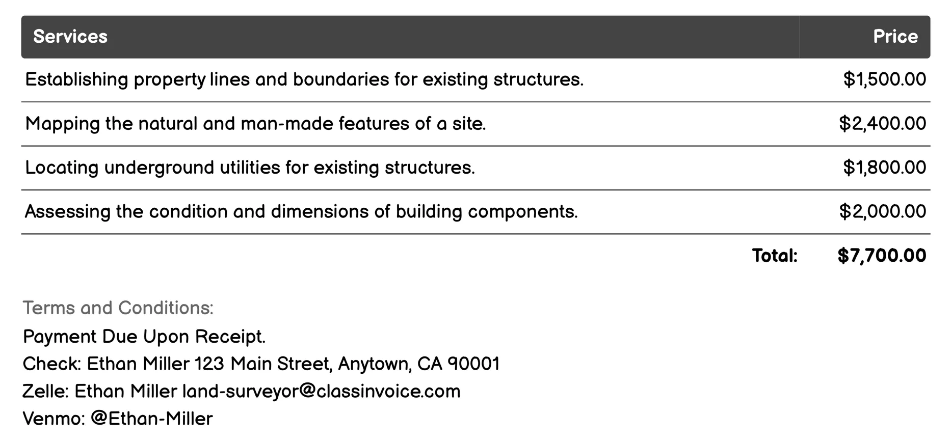
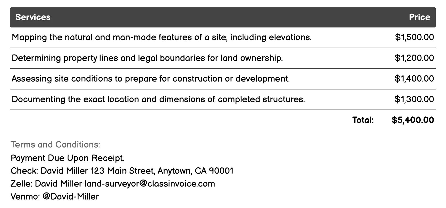
As-Built Surveys Invoice
The 'Land Surveyor for As-Built Surveys' service involves precise mapping and assessment of existing structures. It includes establishing property lines, mapping site features, locating underground utilities, and analyzing structural conditions. This service also creates detailed elevation profiles, plot plans, and verifies site layouts against specifications. Additionally, it assesses property condition, monitors construction compliance, and maps fence locations. Ideal for project invoicing, this comprehensive survey ensures accurate documentation of a property's current state.
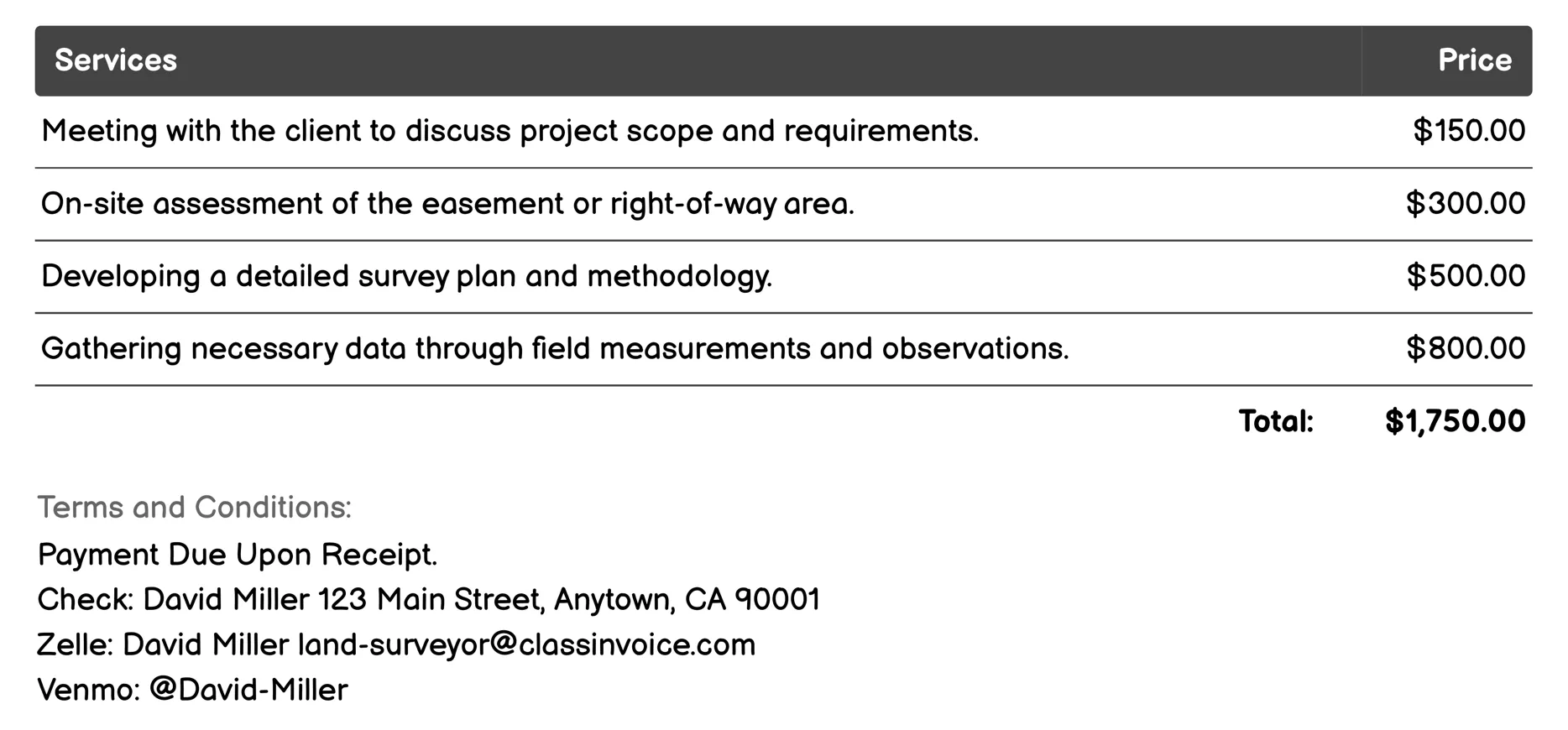
Easement and Right-of-Way Surveys Invoice
This service involves comprehensive land surveying for easements and right-of-way areas. It starts with consulting clients to understand project needs, followed by field assessments and detailed planning. Data is collected and analyzed to draft reports that outline findings and recommendations. Clients review these drafts for revisions before receiving the final report. Additionally, boundaries are physically marked on-site, ensuring clear demarcation. The service concludes with a closeout meeting to ensure all deliverables meet client expectations.
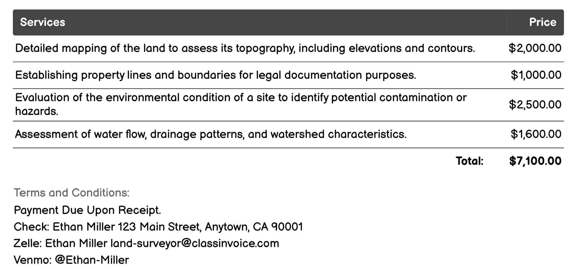
Environmental Impact Assessments Invoice
This service provides comprehensive environmental surveys to assess land for development or conservation. It includes topographical, boundary, and hydrological analyses to map terrain and water flow. Environmental Site Assessments identify contamination risks, while vegetation, soil, and geotechnical surveys evaluate ecological impacts and ground stability. Wildlife habitat assessments ensure biodiversity protection, and cultural resource surveys safeguard historical sites. Additionally, air quality assessments monitor pollution levels, ensuring projects comply with environmental regulations.
FAQ
Is the invoice creation process free ?
Yes, creating an invoice using our service is completely free of charge.
Can I use this service for personal or business purposes ?
This service can be used for both personal and business purposes. No registration or subscription is required.
What can I do with the online invoice creation tool ?
You can create and print invoices, or download them in PDF format for free.
How do I get my printed or PDF invoices ?
You can print your invoices directly from the invoice creation tool, or download them in PDF format for free.
Is the invoice creation process secure ?
Yes, all data is encrypted and stored securely to protect your information.