
Free Land Surveying Invoice Generator
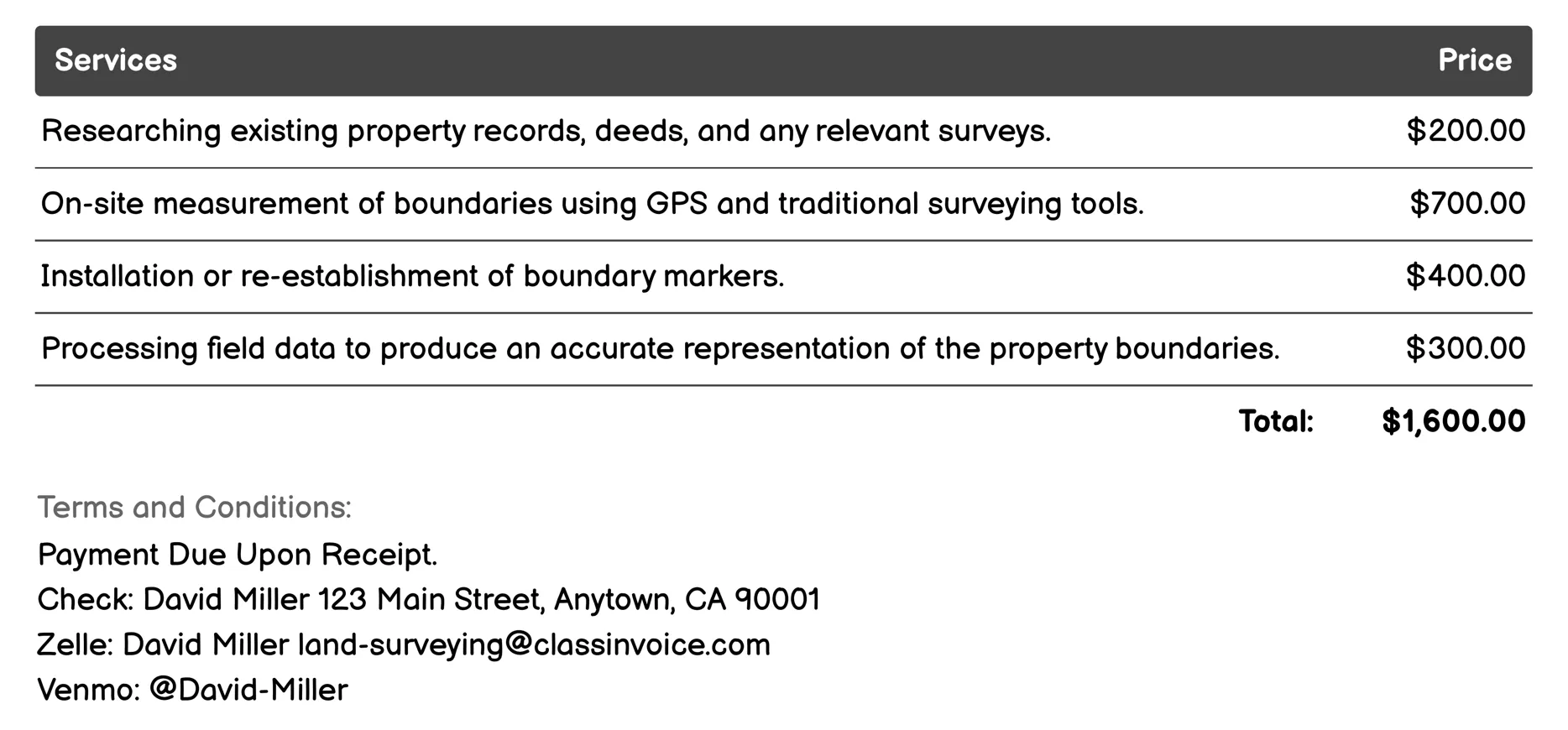
Boundary Survey Invoice
Land Surveying for Boundary Survey involves precise measurement and mapping of property lines. It starts with researching existing records, followed by fieldwork using GPS tools to measure boundaries accurately. Boundaries are marked on-site for clarity. The data is processed into detailed maps and comprehensive reports. This service ensures legal compliance, resolves disputes, and provides aerial views via drones if needed. Re-surveying options are available for verification or dispute resolution.
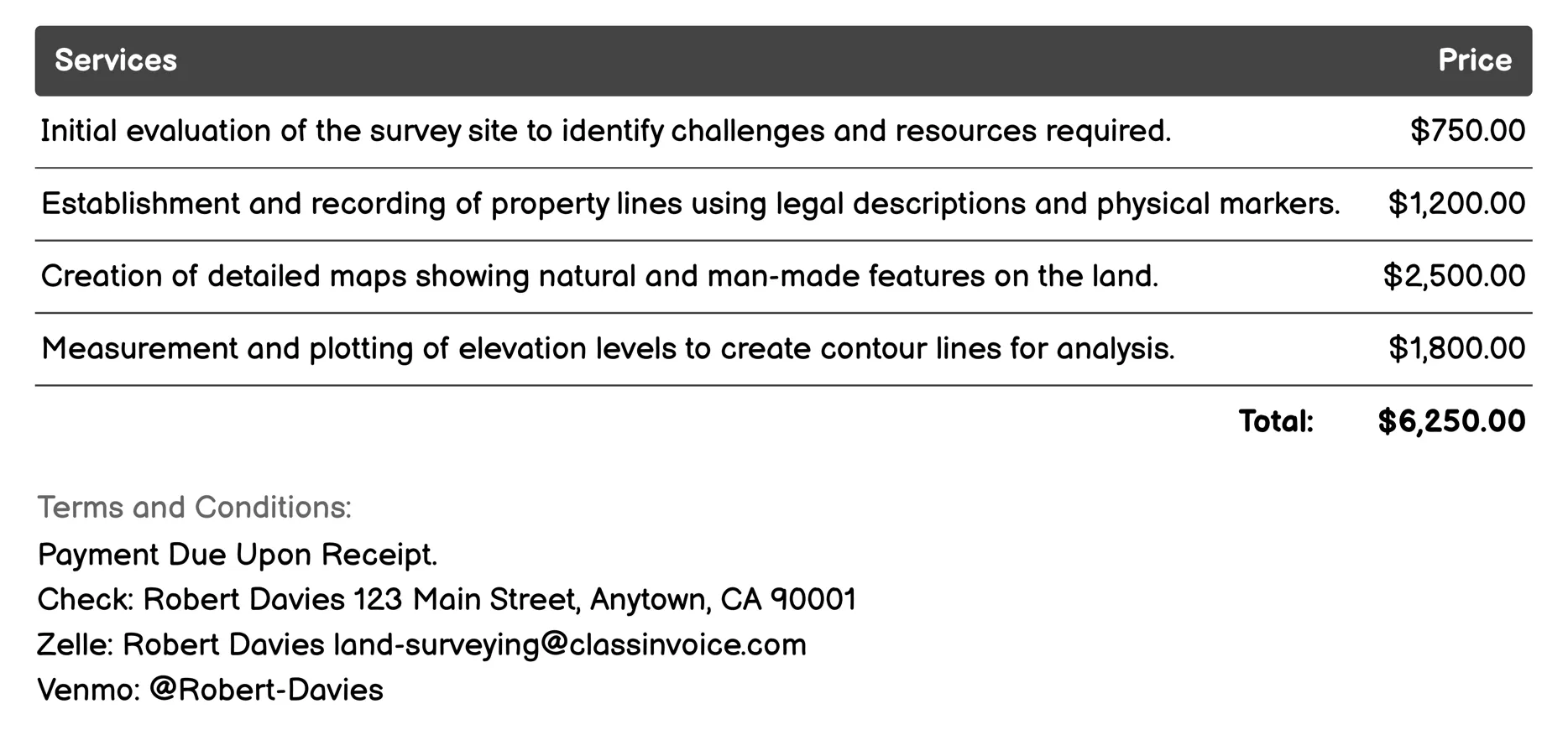
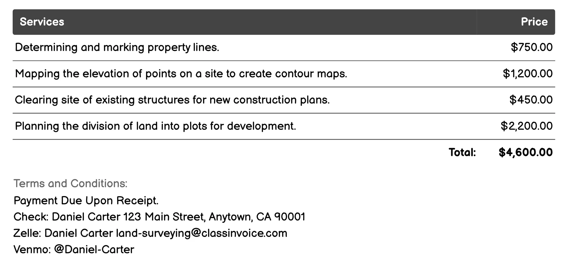
Topographic Survey Invoice
Land Surveying for Topographic Survey provides comprehensive site evaluations, including property boundaries, topography mapping, and elevation contouring. It assesses natural features like vegetation and water bodies, identifies underground utilities, analyzes soil types, maps drainage patterns, and marks key landscape elements such as trees or buildings. This service ensures accurate data collection for construction planning, landscaping decisions, and environmental management.
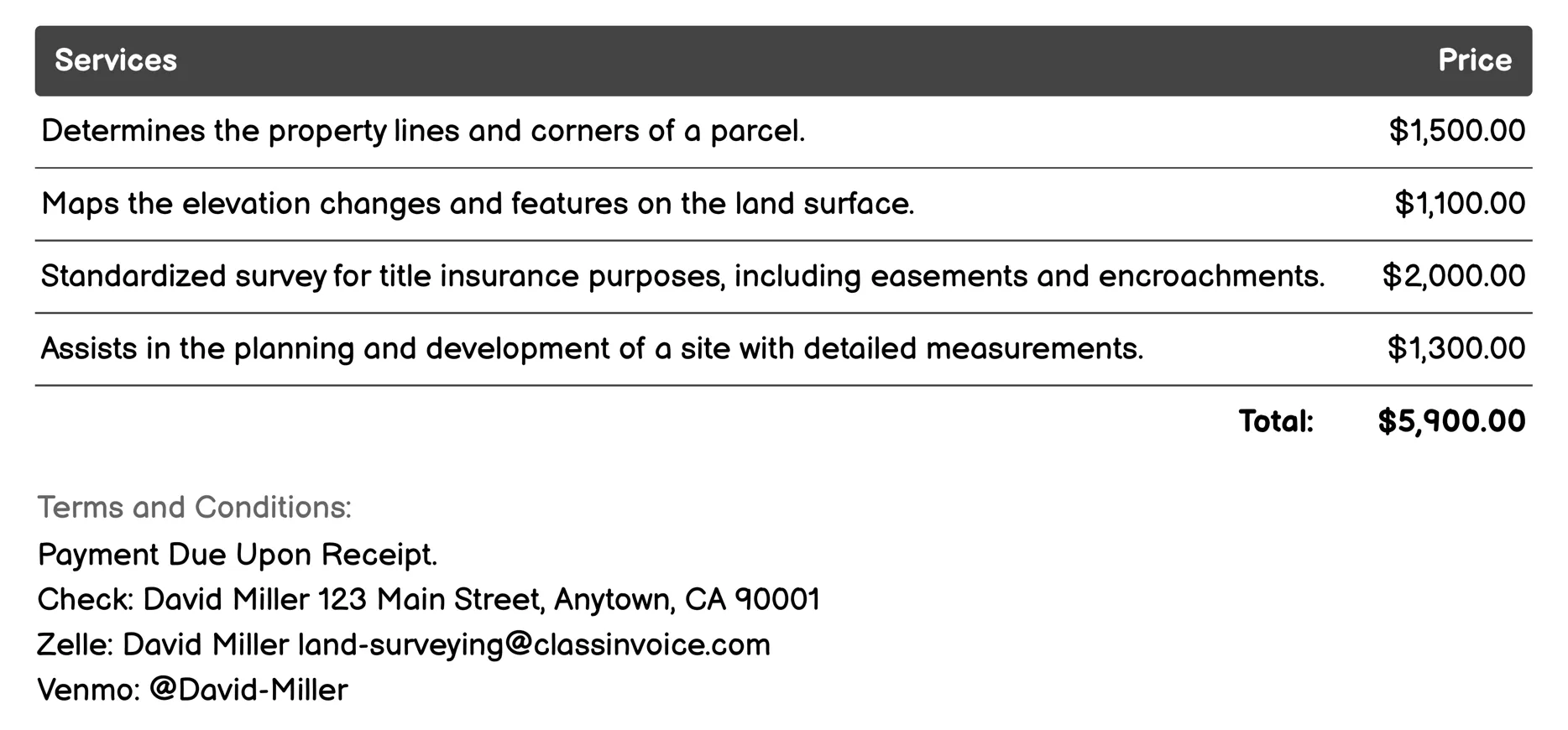
ALTA/NSPS Land Title Survey Invoice
Land Surveying for ALTA/NSPS Land Title Surveys provides precise mapping and documentation services essential for property transactions. It includes boundary determination, topographic mapping, site planning, and construction staking to ensure legal compliance. The standardized survey ensures accurate title insurance reporting by identifying easements, encroachments, and subdivision details. This service guarantees reliable measurements and official reports crucial for buying or selling properties, aiding in clear decision-making and secure transactions.
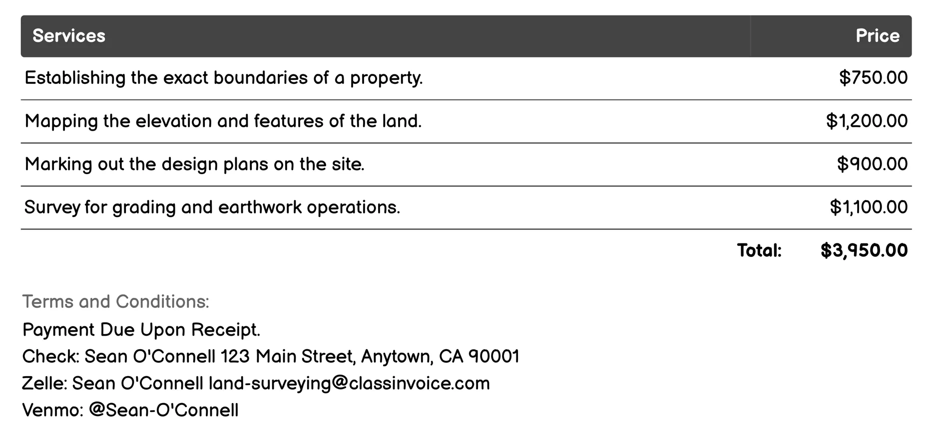
Construction Staking (Layout) Invoice
Land Surveying for Construction Staking involves various precise surveys to guide construction projects. These include boundary and topographic surveys, which establish property limits and map land features. Site planning marks design plans on-site. Grading plan surveys assist in earthwork operations, while as-built surveys document completed work. Utility mark-out locates underground utilities, ensuring safety and accuracy. Drainage plan surveys help design efficient drainage systems. Foundation layout staking marks foundation placements, crucial for structural stability. Roadway surveys aid in road construction layouts. Lastly, environmental impact surveys assess potential site development impacts on the environment.
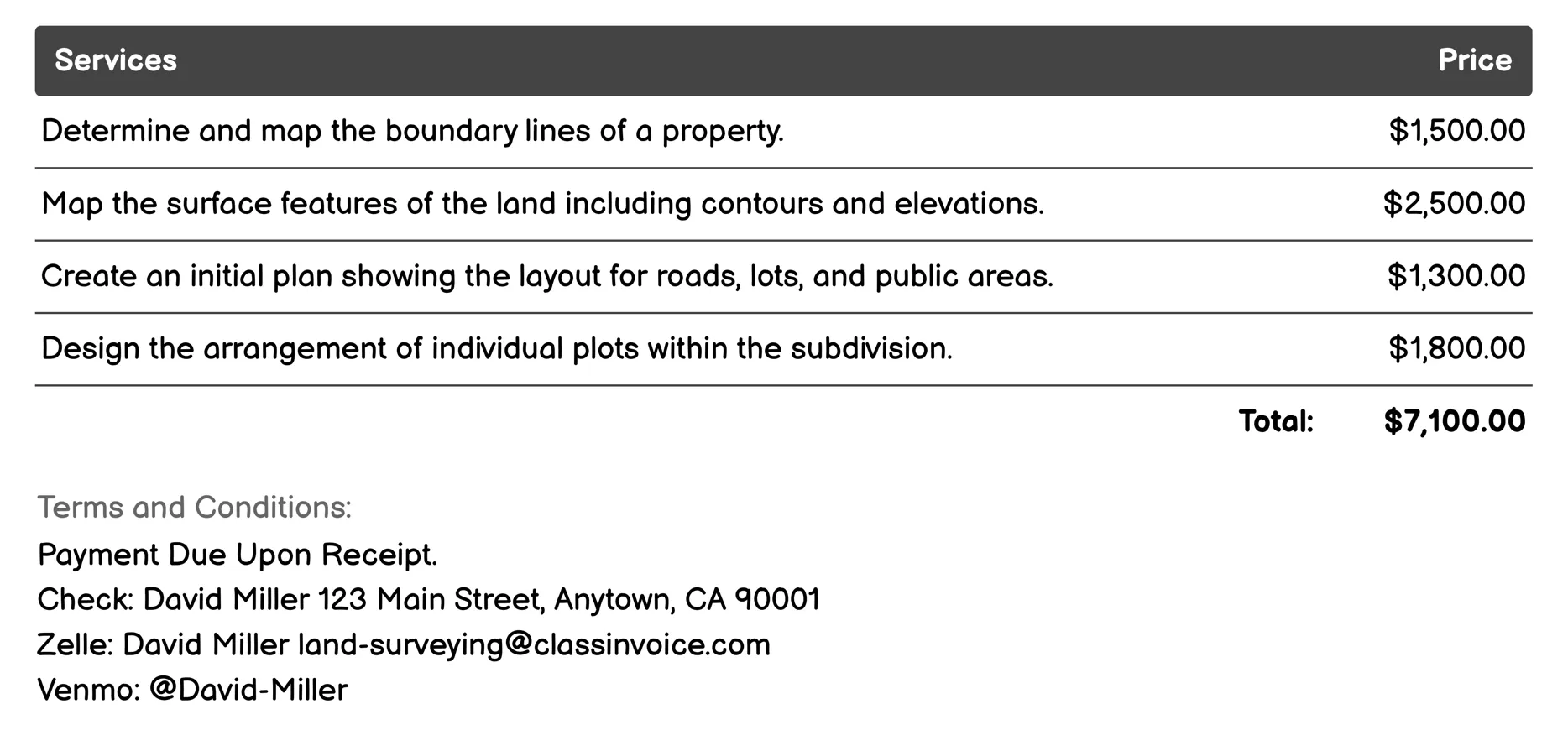
Subdivision Survey Invoice
Land Surveying for Subdivision involves mapping property boundaries, topography, and utilities. It creates initial site plans, designs lot layouts, and assesses environmental factors like wetlands. This service includes marking construction sites, documenting completed structures, and researching historical records to verify ownership and boundaries. Essential for planning new developments, it ensures accurate layout and compliance with legal and environmental requirements.
As-built Survey Invoice
This service offers precise land surveying to verify constructed sites against design plans. It includes boundary surveys, topographic mapping, and utility documentation. Essential for development, it ensures compliance with property lines, verifies as-built elements, and assists in site planning. Surveys like subdivision, easement, and environmental assessments help manage legalities and environmental impacts. Construction staking guides building projects to align with specifications, while roadway alignment surveys ensure roads meet design criteria.
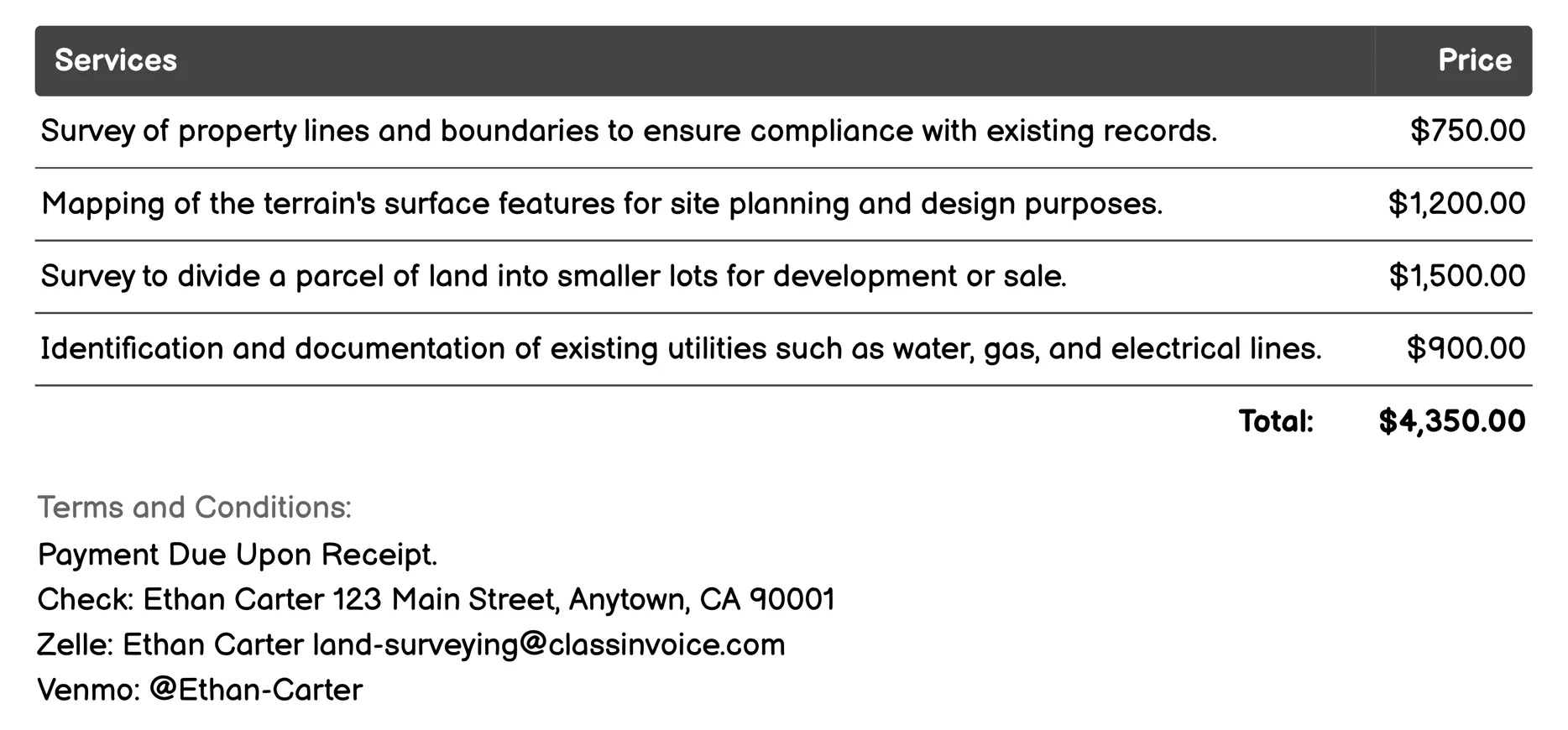
Site Planning Survey Invoice
Land Surveying for Site Planning Survey involves assessing and mapping a property to inform construction and development. Key services include boundary marking, elevation contour mapping, site clearance, subdivision planning, environmental impact assessment, utility location, post-construction documentation, aerial data collection, soil analysis, and infrastructure evaluation. These surveys provide detailed insights into land characteristics essential for safe, compliant, and efficient building projects.
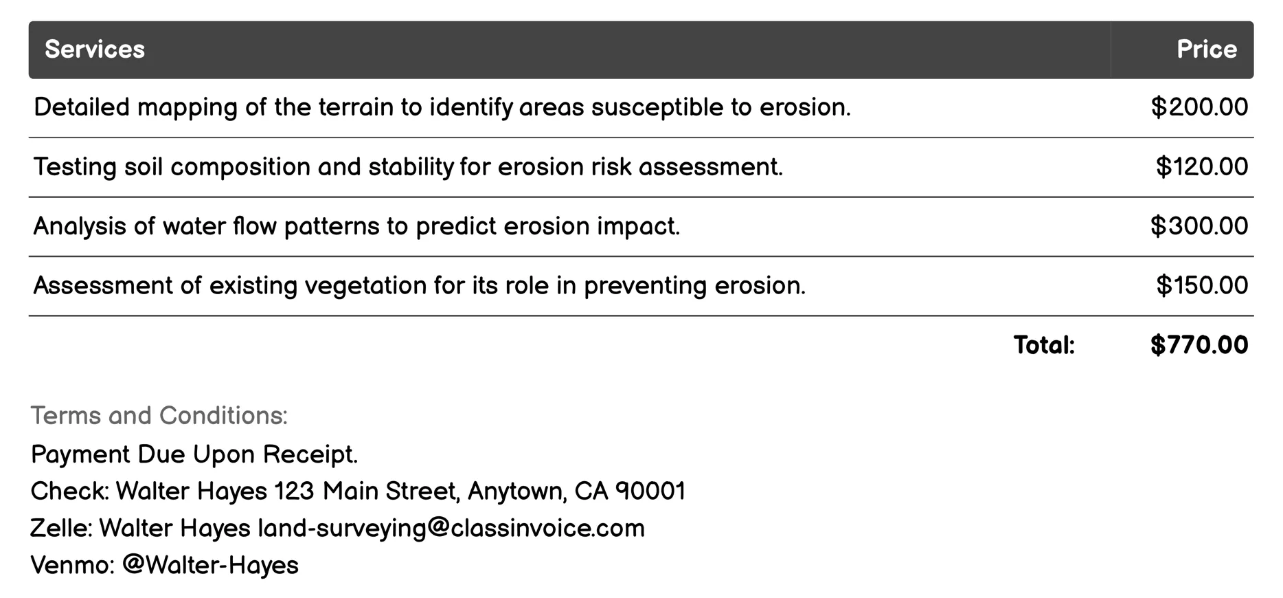
Erosion Control Survey Invoice
This service offers comprehensive solutions for preventing soil erosion. It includes detailed terrain mapping, soil and water flow analysis, vegetation assessment, and risk identification through maps and reports. The process involves developing strategic plans tailored to each site's needs, consulting stakeholders, and ensuring the effectiveness of implemented measures through ongoing monitoring.
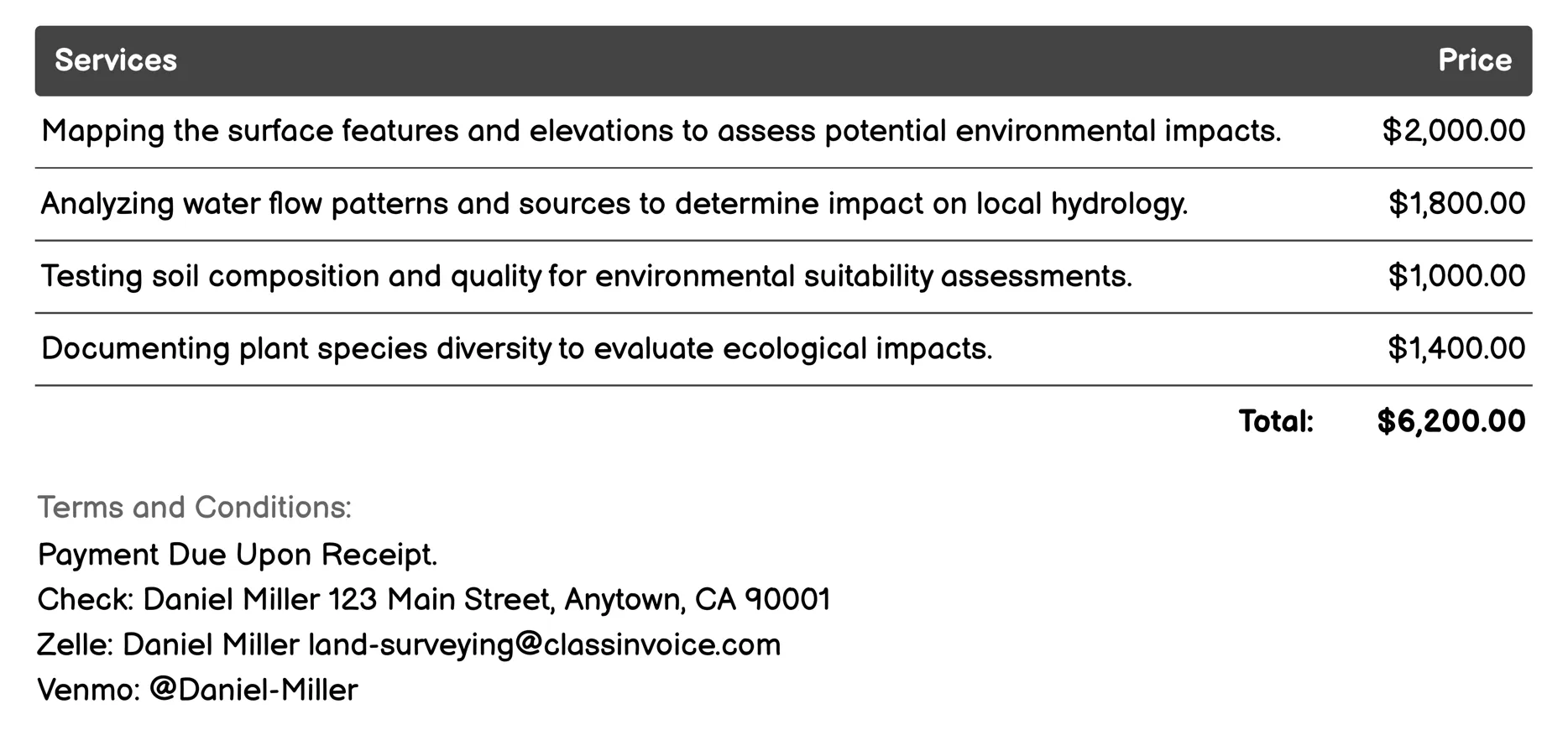
Environmental Impact Survey Invoice
Land Surveying for Environmental Impact Survey provides comprehensive assessments to evaluate potential environmental impacts before development projects. It includes topographic and hydrological studies, soil and vegetation analysis, wildlife habitat evaluations, air quality monitoring, noise impact assessments, cultural resource surveys, wetland delineation, and landscape impact evaluations. These services help ensure that projects comply with environmental regulations and minimize adverse effects on the ecosystem.
FAQ
Is the invoice creation process free ?
Yes, creating an invoice using our service is completely free of charge.
Can I use this service for personal or business purposes ?
This service can be used for both personal and business purposes. No registration or subscription is required.
What can I do with the online invoice creation tool ?
You can create and print invoices, or download them in PDF format for free.
How do I get my printed or PDF invoices ?
You can print your invoices directly from the invoice creation tool, or download them in PDF format for free.
Is the invoice creation process secure ?
Yes, all data is encrypted and stored securely to protect your information.