
Free Aerial Photography Invoice Generator
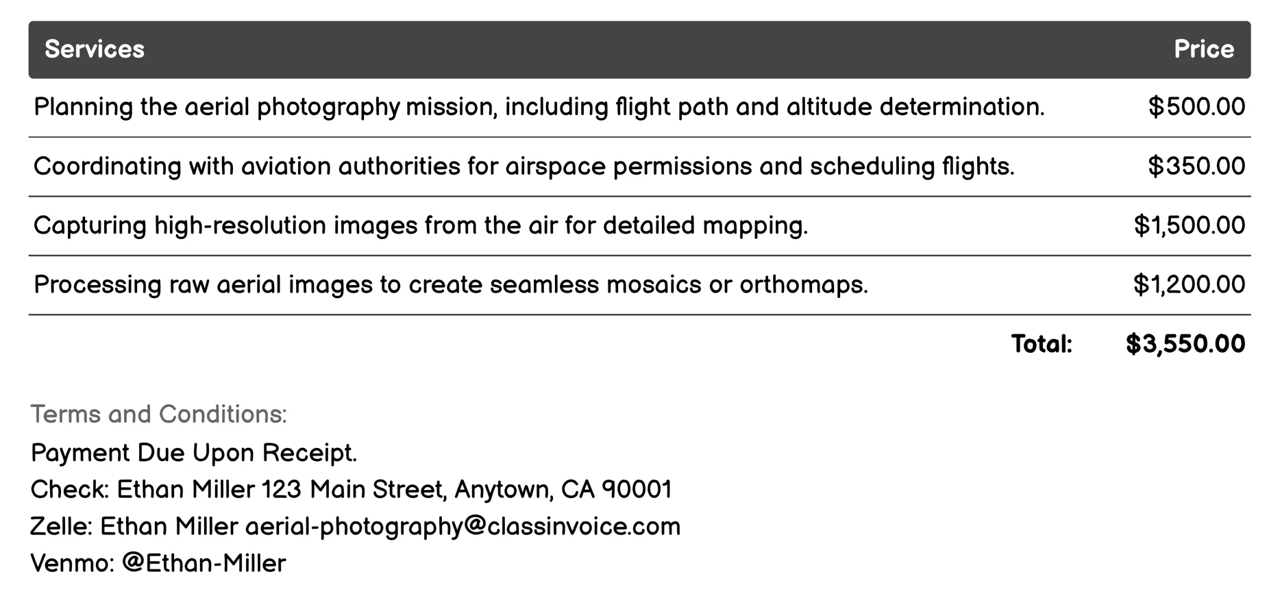
Topographic Mapping Invoice
This service provides aerial photography for precise topographic mapping. It involves planning flights, coordinating with authorities, capturing detailed images from above, and processing these into maps or models. The process includes extracting topographic features and creating accurate 3D terrain models using photogrammetry and LiDAR data. Ground control points ensure image accuracy, while quality checks validate map precision. Ideal for projects needing reliable, high-resolution geographic information.
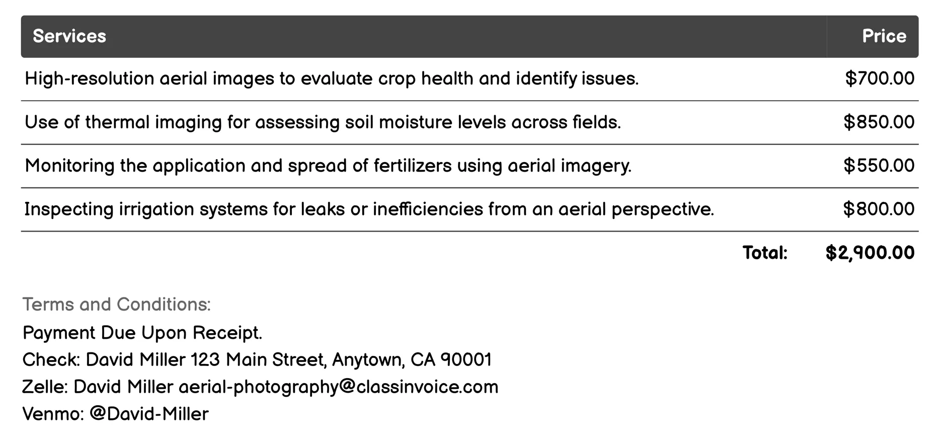
Agricultural Monitoring Invoice
This service provides aerial photography specifically for agricultural monitoring. It includes high-resolution images and thermal imaging to assess crop health, soil moisture, and fertilizer application. Additionally, it involves inspecting irrigation systems, detecting pests, analyzing planting patterns, and estimating yields. The service also maps field boundaries, indexes vegetation using NDVI, and monitors erosion and land degradation. These comprehensive analyses help optimize farm management and improve agricultural productivity.
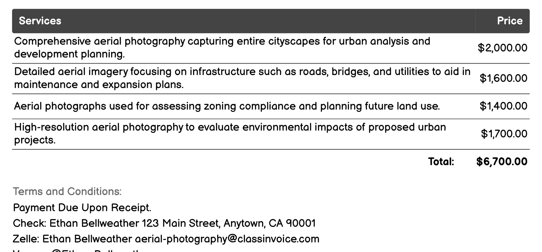
Urban Planning Invoice
This service offers aerial photography tailored for urban planning. It captures comprehensive cityscapes, infrastructure details, and zoning areas to aid development strategies. High-resolution images assess environmental impacts, document historical sites, and optimize public transport and recreational spaces. The service also supports disaster management, traffic analysis, and expansion surveys, providing essential data for efficient urban growth and maintenance.
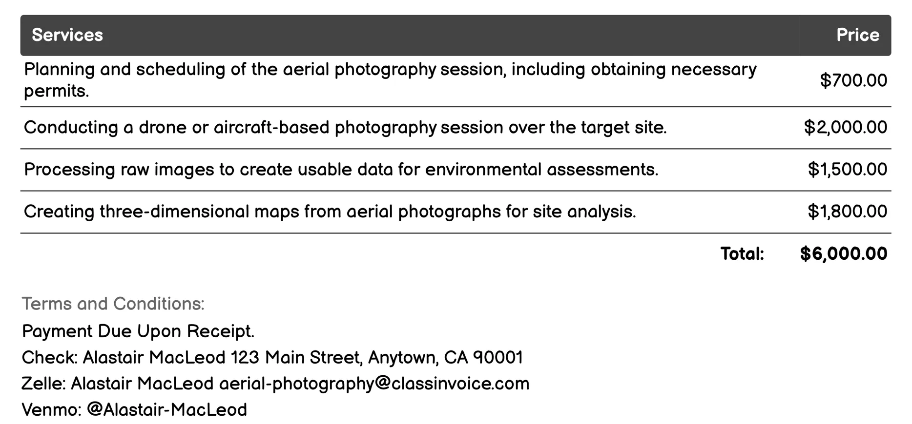
Environmental Assessment Invoice
This service offers comprehensive aerial photography for environmental assessment. It includes planning site surveys, conducting drone or aircraft photography sessions, and processing images to analyze data. Key deliverables are 3D maps, orthophotos, and detailed reports on environmental impact, change detection, vegetation health, water body monitoring, and wildlife habitats. Ideal for stakeholders needing precise ecological insights and documentation.
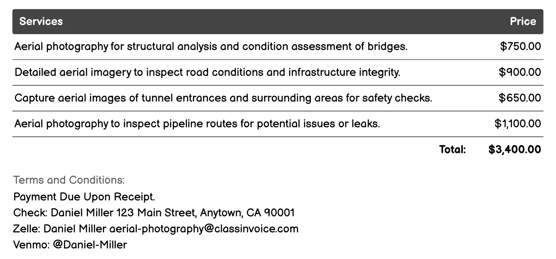
Infrastructure Inspection Invoice
This service offers aerial photography for infrastructure inspection, providing high-resolution images to assess and maintain various structures. It includes inspections of bridges, roads, tunnels, pipelines, railways, dams, power lines, buildings, ports, and airports. These images help identify structural issues, ensure safety, and plan maintenance efficiently. Ideal for clients needing detailed visual assessments without physical access.
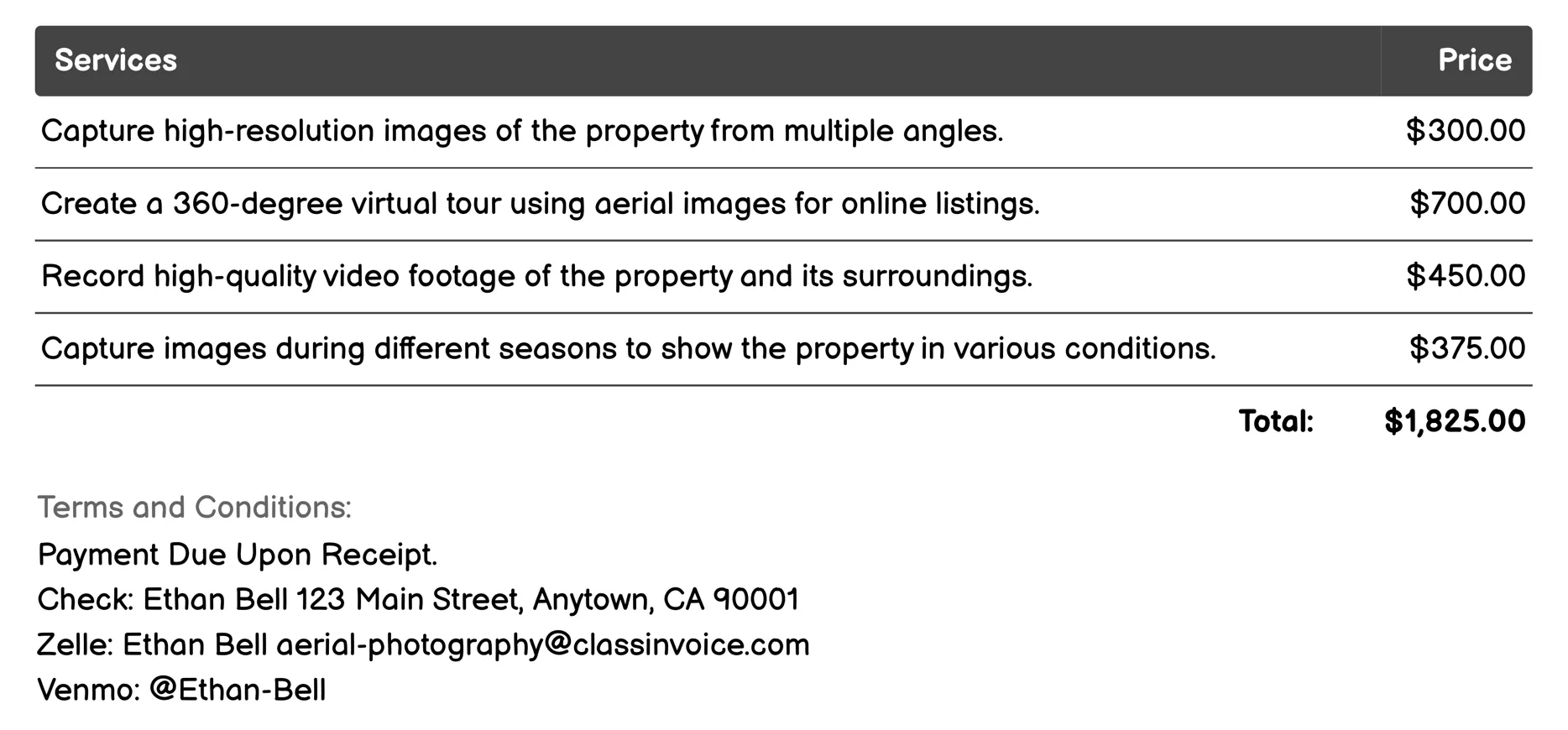
Real Estate Photography Invoice
This service provides aerial photography specifically for real estate, utilizing drones to capture stunning high-resolution images and videos from unique angles. It includes creating virtual tours, panoramic shots, seasonal imagery, and even 3D models of properties. The comprehensive drone mapping aids in detailed surveys and planning. Custom editing ensures professional presentation in listings, enhancing the property's appeal with both indoor and outdoor landscape photos.
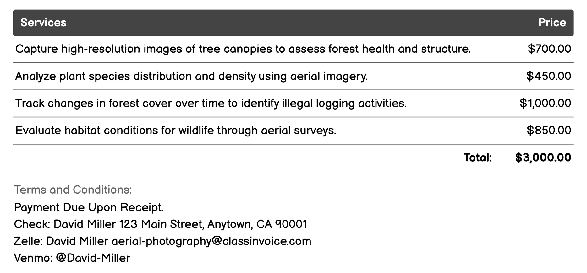
Forestry Management Invoice
This aerial photography service provides comprehensive forestry management solutions. It captures high-resolution images for tasks like tree canopy mapping, vegetation analysis, and deforestation monitoring. The service also supports wildlife habitat assessment, erosion detection, fire risk evaluation, and invasive species identification. Additionally, it aids in forest road mapping, regeneration tracking, and water resource management. These insights help ensure sustainable forestry practices by identifying changes over time and supporting strategic planning.
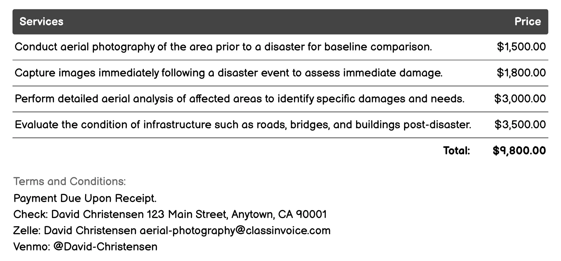
Disaster Assessment Invoice
This service provides comprehensive aerial photography to assess and monitor disaster impacts. It includes pre- and post-disaster site surveys, detailed damage analysis, infrastructure evaluation, and environmental impact assessments. The service aids in recovery planning by mapping floodplains, analyzing urban areas, and evaluating historical structures. It also monitors wildfire damage and tracks recovery progress over time. Ideal for effective disaster response and strategic recovery efforts.
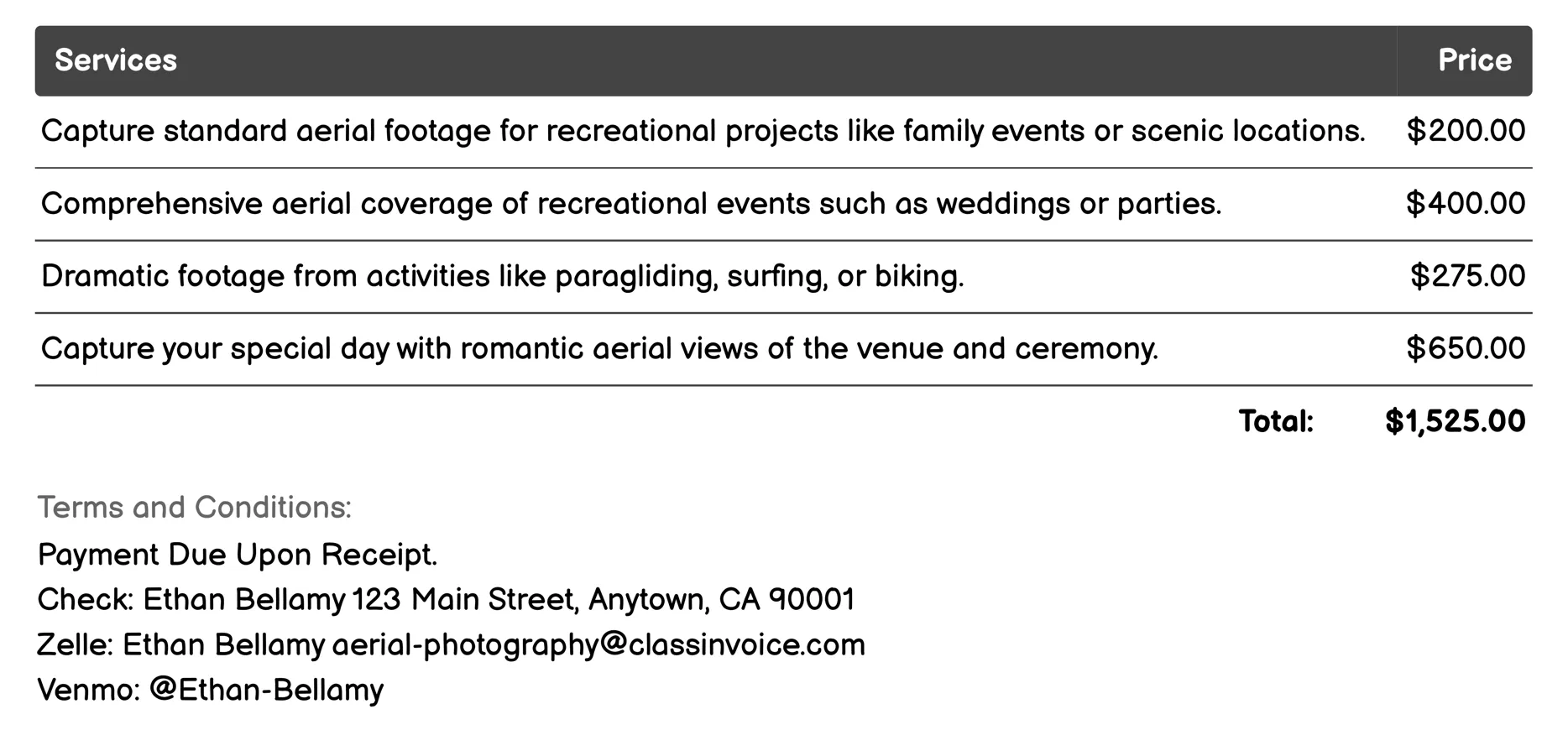
Recreational Filming Invoice
This service offers versatile aerial photography and videography tailored for recreational filming. Capture unique perspectives at events like weddings, parties, or family vacations through high-quality drone footage. Whether documenting scenic landscapes, adventure sports, or bustling beach gatherings, this package provides dynamic and memorable visual content. Each offering is designed to highlight special moments and create lasting memories with professional aerial views.
FAQ
Is the invoice creation process free ?
Yes, creating an invoice using our service is completely free of charge.
Can I use this service for personal or business purposes ?
This service can be used for both personal and business purposes. No registration or subscription is required.
What can I do with the online invoice creation tool ?
You can create and print invoices, or download them in PDF format for free.
How do I get my printed or PDF invoices ?
You can print your invoices directly from the invoice creation tool, or download them in PDF format for free.
Is the invoice creation process secure ?
Yes, all data is encrypted and stored securely to protect your information.